4. Natural Environment
The goals and policies herein build on the citywide Comprehensive Plan Environment Element policies. What is unique about the Finn Hill Neighborhood is the amount of forested hills, natural stream corridors and shoreline areas concentrated within the City of Kirkland, which is reflected in the neighborhood’s vision statement on protecting the local natural environment.
During the development of the Finn Hill Neighborhood Plan, the following priorities were emphasized through community outreach exercises:
● Conserve the natural environment, including tree canopy, wildlife habitat, streams, and wetlands.
● Restrict and enforce development standards to protect critical areas, including streams, wetlands, and steep slopes susceptible to erosion and landslide hazards.
● Provide wildlife corridors and recreational connectivity.
● Ensure development standards protect the natural environment and forested neighborhood character.
Goal FH-1: Protect and enhance Finn Hill Neighborhood’s natural environment.
Protect and enhance the natural environment by retaining native topography, tree canopy, and stream and wildlife corridors, which are key to stabilizing steep slopes, controlling storm water, and preserving neighborhood character.
Goal FH-2: Require new development to preserve and protect ecosystem functions.
Compliance with the Zoning Code regulations regarding tree retention, critical areas, and geologic hazardous areas is necessary to ensure that new development, redevelopment and land surface modification meet neighborhood expectations and relevant goals and policies.
Trees and Forest Ecosystems
Goal FH-3: Maintain a healthy, sustainable urban forest through the protection and restoration of native trees, vegetation, and soil.
To protect Finn Hill’s neighborhood character and natural environment, concern for existing and future urban tree canopy coverage (UTC) emerged as a neighborhood priority. The benefits associated with protecting Finn Hill’s tree canopy include:
● High tree canopy coverage contributes to lower storm water runoff volumes, lower peak stream flows and fewer flooding incidents.
● Protecting native vegetation reduces soil erosion, preventing sediment and other pollutants from entering streams and Lake Washington.
● Preserving continuous tree canopy is important for maintaining wildlife habitat and providing wildlife corridors.
● Protecting native trees and vegetation helps to protect soil ecosystems. In return, soils and the communities of microorganisms that they support are important in supporting healthy native trees and vegetation.
Policy FH-3.1: Preserve and restore tree canopy throughout the neighborhood.
Maintaining tree canopy is a priority for the entire Finn Hill Neighborhood. See section below regarding the Holmes Point Overlay area (HPO), where a tree canopy goal for the area is established to help preserve steep slopes, soil, vegetation and trees through designated protected natural areas. Other Zoning Code regulations require that open space covenants and easements be recorded on property to protect critical areas and slopes, in conjunction with strong development standards described in Policies FH-3.2, FH-4.6 and FH-4.9.
Preserving forest canopy and ecosystem function is also achieved through public purchase of land. Implementation of many of the strategies in the Kirkland Urban Forestry Strategic Management Plan also works toward achieving this policy.
Policy FH-3.2: Establish regulations to protect trees during development, particularly large native trees and groves, and require restoration of trees, vegetation and soil impacted by development.
Strengthening tree retention regulations is a major concern of Finn Hill residents. The majority of residents support more stringent limits on tree removal, including the need for enforcement of adopted regulations. Residents want protection of existing trees, retention of tree canopy and restoration of impacted areas.
Protecting mature trees is important for the aforementioned reasons, as larger trees substantially improve air quality, mitigate storm water, reduce heat island temperatures, sequester more carbon, offer diverse wildlife habitat opportunities and contribute to neighborhood character. Emphasis should be on retaining and replanting native tree species such as Douglas fir, vine maple and madrone trees.
The City should improve and enforce regulations which may result in amending Chapter 70 KZC, Holmes Point Overlay, and Chapter 95 KZC, Tree Management and Required Landscaping regulations.
Policy FH-3.3: Protect soil quality during development.
Protecting and enhancing soil quality focus not just on characteristics such as nutrient availability, but also focus on soil biological activity, organic matter content, water infiltration, and soil structure. Therefore native soils should be kept intact as much as possible, preventing soil compaction, erosion and removal during construction activities. Soil quality can be protected by (1) reducing the allowable clearing and grading areas; (2) limiting disturbance to native soils during construction; (3) applying protective layers of mulch blankets over soils where heavy equipment access is required; (4) complying with erosion control requirements; and (5) salvaging and storing native topsoil for reapplication to the site. Low impact development techniques and soil requirements for planting new native trees and vegetation are encouraged in the Zoning Code to implement this policy.
In addition to these policies that address tree protection, the policies in the Holmes Point Overlay section below are also relevant.
Streams, Wetlands, and Shorelines
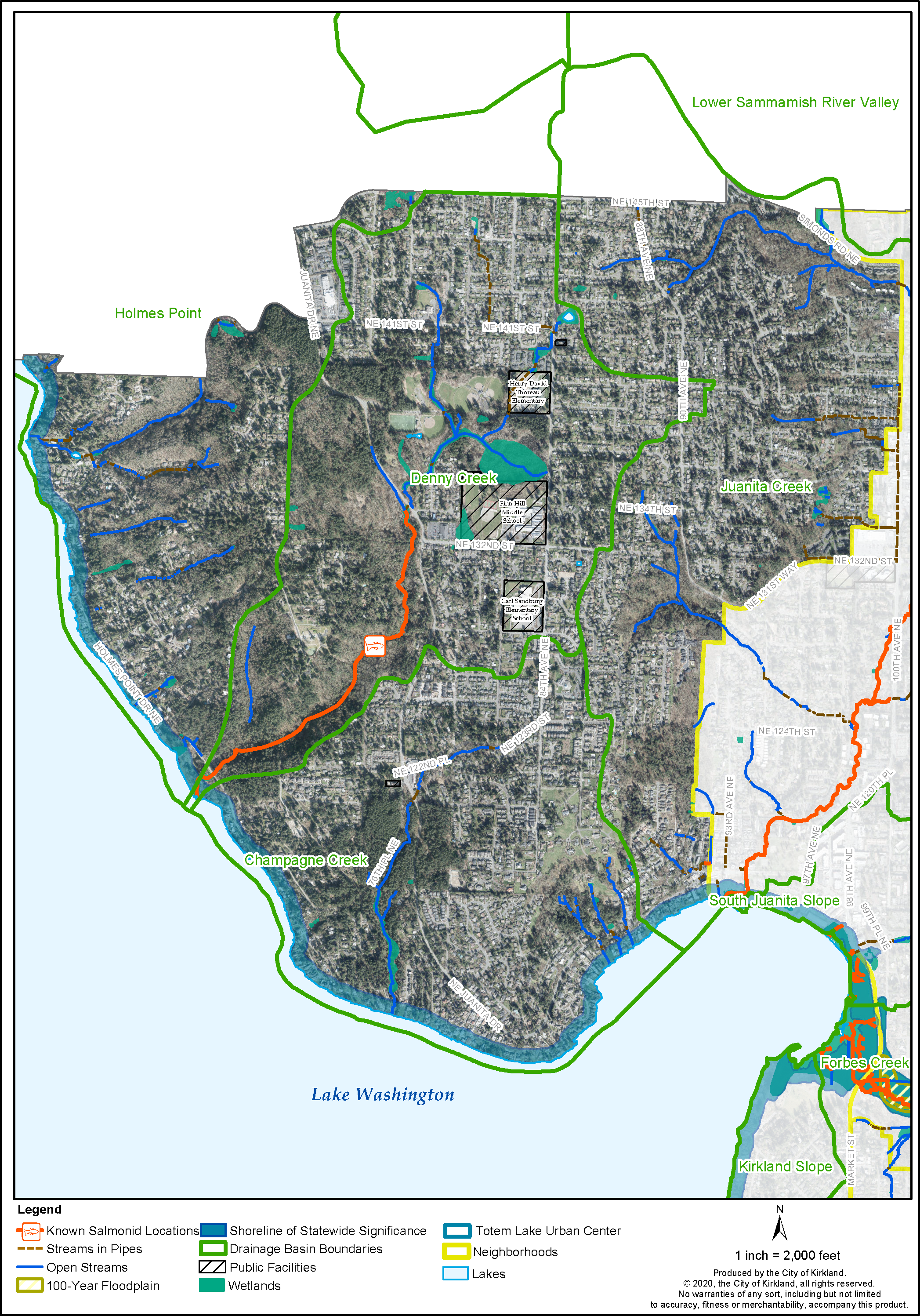
Finn Hill contains many streams, particularly along the western edge of Lake Washington’s shoreline, and a number of wetlands (See Figure FH-4.1). The residents of Finn Hill feel strongly that streams, wetlands and the Lake Washington shoreline habitat should be protected and restored. These values are consistent with adopted policies in the Environment and Shoreline Area Elements of the Comprehensive Plan, regulations in Chapter 90 KZC, Critical Areas: Wetlands, Streams, Minor Lakes, Fish and Wildlife Habitat Conservation Areas, and Frequently Flooded Areas; Chapter 83 KZC, Shoreline Management, and City-sponsored volunteer restoration programs.
Figure FH-4.1: Finn Hill Wetlands, Streams, and Lakes
Goal FH-4: Preserve and restore streams, wetlands and shorelines and protect their biological integrity, including in-stream and adjacent riparian habitat.
Policy FH-4.1: Encourage public and private property owners to protect and enhance streams, wetlands, and buffers for wildlife habitat and corridors.
The 2014 Surface Water Master Plan includes an inventory conducted for Finn Hill prior to annexation which describes techniques property owners and the community can do to improve streams and wetlands, including:
● Removing trash debris from streams and wetlands.
● Removing structures or barriers to improve fish passage.
● Restoring stream channels and buffers to improve habitat.
● Monitoring streams and wetlands for invasive species.
● Adding woody debris to streams.
● Removing invasive species from buffers and planting with native vegetation.
● Educating residents about stream bacterial loads caused by pet waste.
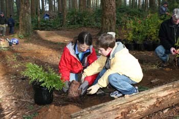
The neighborhood, in cooperation with the City’s Green Kirkland Partnership program, can help restore streams, wetlands and forested areas. The Finn Hill Neighborhood Alliance in cooperation with the City can disseminate information encouraging property maintenance that will preserve and enhance the quality of neighborhood streams and wetlands.
Policy FH-4.2: Work with public and private property owners on education and compliance with shoreline regulations and to enhance shoreline habitat along Lake Washington.
Development located within the jurisdiction of the Shoreline Management Act must comply with the state and local shoreline regulations in Chapter 83 KZC. Kirkland is a Green Shores™ for Homes (GSH) pilot city. GSH is a voluntary incentive-based program designed specifically for shoreline properties. Other shoreline habitat policies for Kirkland are contained in the Shoreline Area Chapter of the Comprehensive Plan and the Parks, Recreation and Open Space (PROS) plan.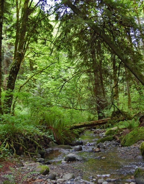
Surface Water
Unmanaged surface water contributes to environmental degradation through reduction in water quality, erosion of ravines and streams, and flash flooding. Preventing and minimizing these adverse impacts are important to the Finn Hill Neighborhood. Implementing Low Impact Development (LID), which encourages infiltrating surface water on site, and other techniques to reduce surface water volume and pollution, are the main approaches for addressing surface water. LID techniques improve water quality by filtering surface water before entering Lake Washington.
City policy and regulatory documents that address these issues are the Surface Water Master Plan (SWMP), Chapter 15.52 KMC and Chapter 90 KZC, Critical Areas: Wetlands, Streams, Minor Lakes, Fish and Wildlife Habitat Conservation Areas, and Frequently Flooded Areas. The SWMP includes an inventory of surface water issues in Finn Hill that should be implemented as resources are available. Policy FH-4.1 above lists several techniques that property owners can do to improve stream corridors.
Policy FH-4.3: Use natural storm water solutions to protect fish and other aquatic organisms (e.g., low impact development reducing runoff from impervious surface area).
Residents support use of low impact development (LID) techniques such as rain gardens, pervious paving, cisterns, land conservation, green roofs, bio-swales, infiltration systems such as trenches and drywells, and other forms of bioretention, curb extensions, cascades, and porous gutters.
Policy FH-4.4: Educate property owners and residents to prevent point and nonpoint source pollution to improve water quality in local streams and Lake Washington.
The City together with the Finn Hill Neighborhood Alliance should provide educational awareness and enforcement programs to help prevent point and nonpoint source pollution.
Policy FH-4.5: Conduct retrofit planning for existing conditions with the goal of improving hydrology and water quality consistent with the Surface Water Master Plan.
Retrofit planning is the development of storm water flow control and water quality treatment facilities to serve existing development that does not currently have such facilities, or that has facilities designed to old or out-of-date standards. Facilities can be either decentralized small ones that serve individual streets or buildings, or regional large facilities that serve multiple buildings and streets.
Slopes and Geologically Hazardous Areas
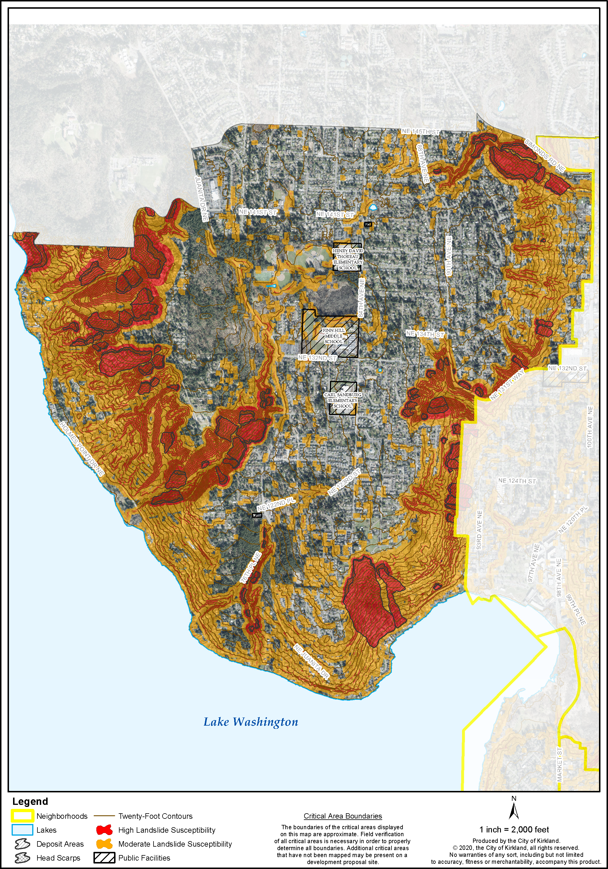
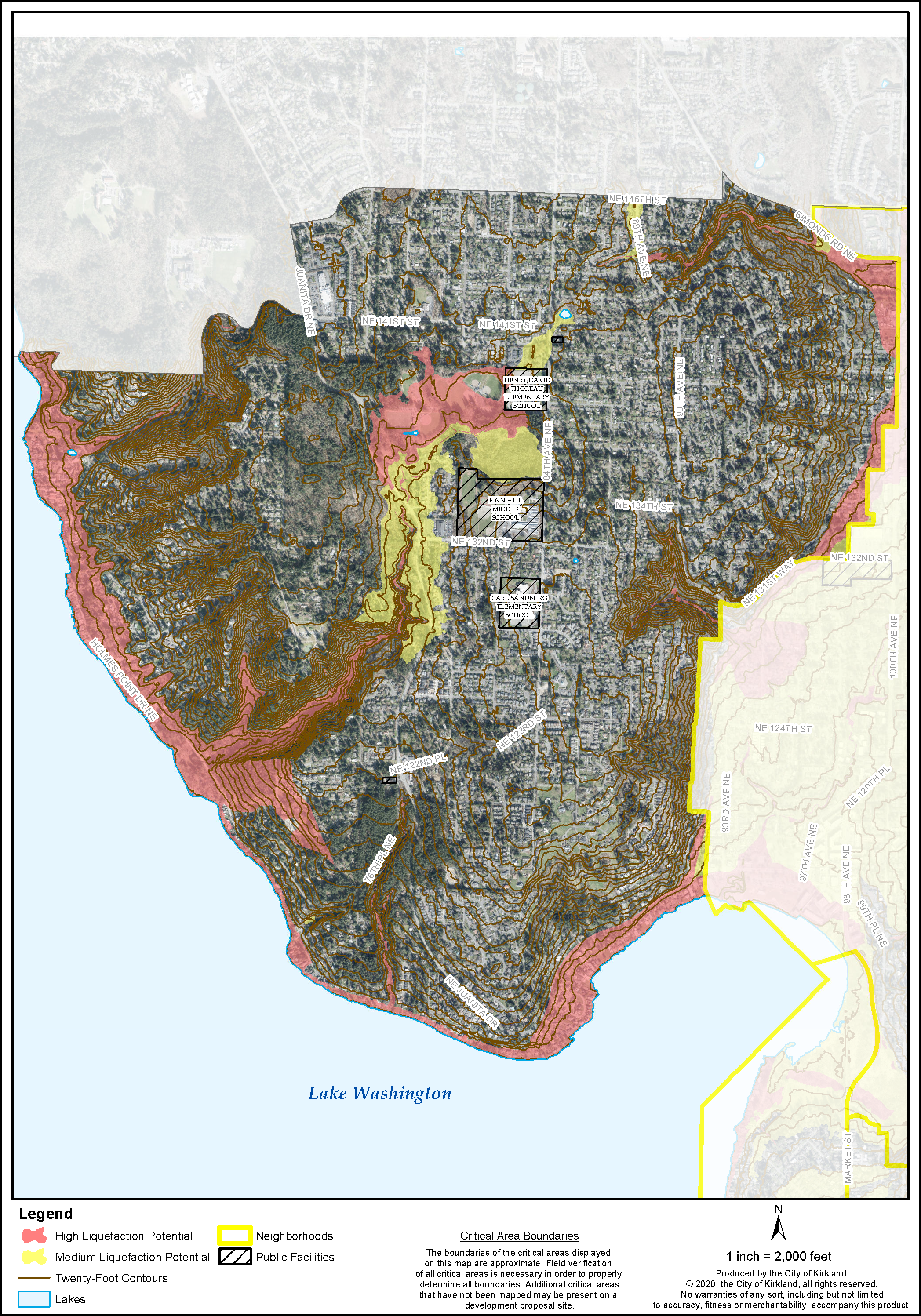
Finn Hill’s topography includes many steep slopes and stream corridor ravines, particularly on the east, south, and west edges of the neighborhood (see Figure FH-4.2a: Finn Hill Landslide Susceptibility). These geologically hazardous areas and ravines are susceptible to erosion and landslides, particularly if disturbed and existing vegetation is removed. Soils susceptible to seismic hazards (including liquefaction) are generally located in areas containing wetlands (see Figure FH-4.2b: Finn Hill Liquefaction Potential).
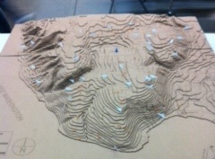
3-Dimensional Model of Finn Hill Topography
Source: U.W. Green Futures Lab
Chapter 85 KZC, Critical Areas: Geologically Hazardous Areas, establishes the regulations applied to development on property containing geologically hazardous areas. In Seismic and Landslide Hazard Areas, development activity is subject to increased scrutiny and must comply with regulations to control erosion contained in KMC Title 15, along with Chapter 70 KZC, Zoning Code Holmes Point Overlay; Chapter 95 KZC, Tree Management and Landscaping; and the critical area regulations for wetland and streams in Chapter 90 KZC.
Figure FH-4.2a: Finn Hill Landslide Susceptibility
Figure FH-4.2b: Finn Hill Liquefaction Potential
Policy FH-4.6: Protect moderate and high landslide areas by limiting development and maintaining existing vegetation.
Controlling erosion and preventing landslides is a desired goal expressed by Finn Hill residents.
Consistent with the regulations for property containing geologically hazardous soils in the City’s codes, standards for limiting development on steep slopes should include:
● Conduct slope stability and structural analysis to minimize damage to life and property.
● Retain steep slopes in a natural condition through the creation of greenbelt easements.
● Locate development away from steep slope areas and drainage courses to preserve significant groupings of native trees and vegetation. Flexibility in lot size, clustering of housing units and placement of proposed improvements may be necessary to achieve this.
● Restrict lot coverage to retain vegetation and consider policies controlling setbacks.
● Control surface water runoff at predevelopment levels.
● Retain watercourses and wetlands in a natural state.
● Retain native trees and vegetation to the maximum extent.
Holmes Point Overlay
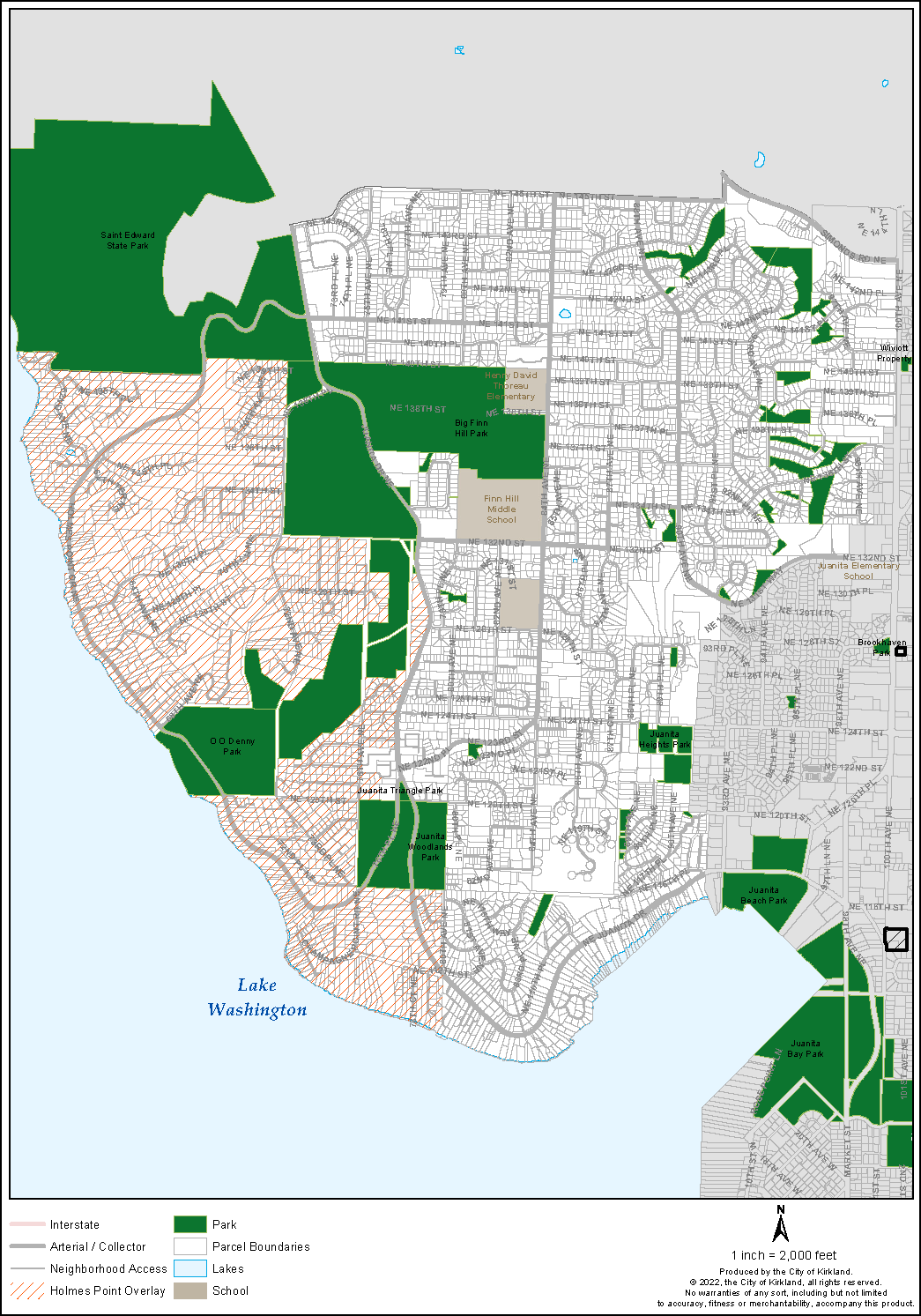
The Holmes Point Overlay (HPO) area is generally located west of Juanita Drive (see Figure FH-4.3). The HPO is dominated by the largest area of sensitive environmental features in the City, including stream corridors, steep slopes greater than 40 percent, and slopes susceptible to moderate and high landslide and erosion hazards.
The Holmes Point Overlay zone is a regulatory overlay with the purpose of providing increased environmental and tree protection in the Holmes Point area. The HPO regulations have existed in King County since 1999 and were carried over to Chapter 70 KZC with the 2011 annexation.
The intent of the HPO overlay is to limit the amount of site disturbance on lots in order to protect vegetation, tree cover and wildlife, retain natural topography, protect potentially geohazardous slopes, reduce visual impacts of development, and maintain community character. The HPO regulations limit maximum lot coverage and provide greater tree retention requirements beyond what is allowed outside the HPO, and require a portion of the lot to be designated for tree and vegetation retention in perpetuity as a Protected Natural Area (PNA).
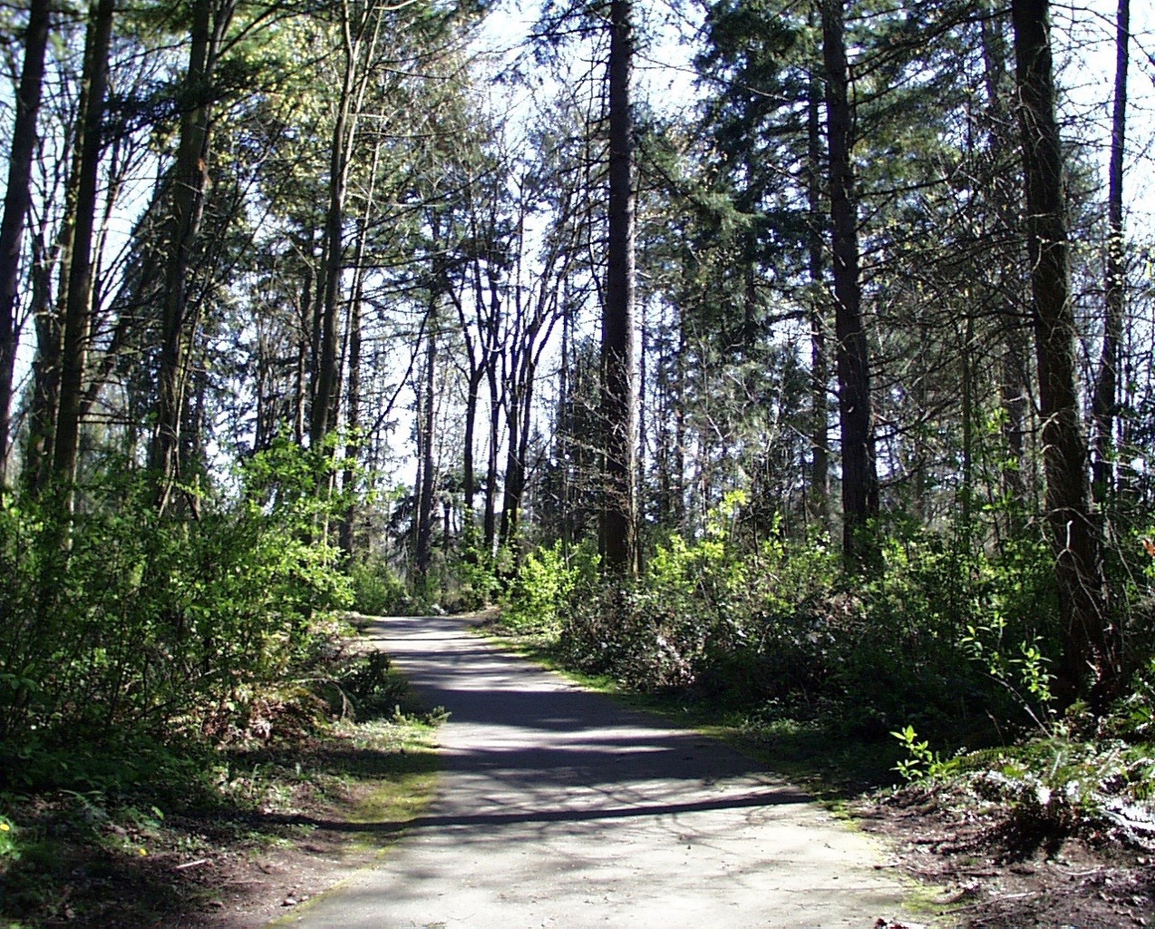
Policy FH-4.7: Protect, enhance and restore trees in the HPO with a tree canopy goal of 60 percent.
Tree and canopy protection is a significant concern of Finn Hill residents. The environmental conditions in the HPO area mentioned above justify a higher level of tree retention in order to help maintain a tree canopy of 60 percent within the Holmes Point Overlay zone compared to the tree canopy goal for the rest of the City at 40 percent (see Environment Element of the Comprehensive Plan).
Figure FH-4.3: Holmes Point Overlay
Policy FH-4.8: Strengthen the regulations and enforcement of the Holmes Point Overlay (HPO).
To meet the canopy goal, the neighborhood supports clarifying and strengthening the HPO regulations. Concerns are that during the development review process a greater number of trees are removed than the intent of the HPO regulations allows. Because of environmental, topography or constraints of development such as location of vehicular access or utilities, the number of lots or residential density allowed by zoning may not be achievable in all cases. Balancing the intent of the HPO policies and regulations for greater retention of trees and natural areas with property rights and the underlying zoning density will be necessary in order to meet the neighborhood goals and policies.
Policy FH-4.9: Limit site disturbance and retain trees and native vegetation on slopes to avoid or minimize damage to life and property.
Because of the natural constraints of the HPO area discussed above, development in the HPO area should be subject to the following development standards and as contained in Chapter 70 KZC, Holmes Point Overlay Zone; Chapter 85 KZC, Critical Areas: Geologically Hazardous Areas; and Chapter 90 KZC, Critical Areas: Wetlands, Streams, Minor Lakes, Fish and Wildlife Habitat Conservation Areas, and Frequently Flooded Areas:
● Limit the amount of site disturbance.
● Limit the amount of impervious surface or lot coverage.
● Retain a percentage of lot in open space.
● Retain trees and natural vegetation and soils to a greater extent than outside the HPO.
● Preserve and protect natural areas in perpetuity within an easement recorded on the property.
● Provide supplemental replanting of native vegetation, evergreen trees and soil enhancement.
● Cluster lots, limit site disturbance and locate vehicular access away from the steepest slopes.
● Prepare geotechnical report and slope stability analysis.
● Retain and enhance watercourses.
● Review and approve short plats and subdivisions with integrated development plans so that the amount of site disturbance for locating structures, utilities, access and tree retention/removal is determined prior to beginning construction.
Policy FH-4.10: Encourage clustering development away from slopes susceptible to moderate and high landslide potential to retain natural topography, vegetation and avoid damage to life and property.
Clustering of development away from slopes should be a priority during development review to retain topography, trees, and vegetation and minimize disturbance to moderate and high landslide hazard slopes. A qualified geotechnical engineer or engineering geologist may make other recommendations to be implemented during the permit review and construction phases of development.
Policy FH-4.11: Conduct a neighborhood education program on the importance of tree retention, planting of native vegetation and HPO regulations.
Educational programs for property owners, developers, and tree removal companies on topics such as tree maintenance and HPO code requirements would encourage stewardship of the urban forest and citizen awareness of violations to help achieve the goals of the HPO. Property owners could also be encouraged to increase planting native vegetation and trees. The City and neighborhood should partner together to conduct educational programs to support the intent of the HPO regulations.
Wildlife Habitat
Finn Hill residents greatly value the fish, plants, and wildlife that live in the neighborhood and strongly support protecting and restoring wildlife habitat. Wildlife habitat areas provide food, protective cover, nesting and breeding areas, and corridors for movement for native plants, fish, or wildlife, including but not limited to threatened, endangered, migratory and priority species. There are several known eagles’ nests located on the west side of Finn Hill above Lake Washington as well as herons, owls, pileated woodpeckers, and coyotes in the neighborhood.
Historically, Finn Hill was blanketed with a dense conifer forest, including Douglas fir, western red cedar, and western hemlock. Forest fires were frequent occurrences resulting in a patchwork of conifer forest and burned areas dominated by native shrub species, including vine maple, huckleberry, salal, and Oregon grape. While it is impossible to return to these conditions, an ideal urban forest provides wildlife habitat and corridors that reflect the habitat requirements of key species.
Previous sections Slopes and Geologically Hazardous Areas, Trees and Forest Ecosystems, and Streams, Wetlands, and Shorelines build on the policies below. The funding policy identified in Policy FH-3.1 will be instrumental in setting aside land for wildlife habitat. In addition, the Green Loop discussed in Section 5 (Parks and Open Space) provides an opportunity to improve, connect, and protect wildlife corridors.
Finn Hill already contains a number of protected open space and natural areas (See Figure FH-4.3). These are managed by multiple governmental bodies, including City of Kirkland, City of Seattle, and King County. The continued preservation of these protected areas will require cooperation between Finn Hill residents and these entities.
Policy FH-4.12: Promote and educate the public about wildlife and backyard habitat, in conjunction with Kirkland’s designation as a certified Community Wildlife Habitat by the National Wildlife Federation.
Additional opportunities for improving wildlife habitat that could be explored include encouraging safe snag tree retention on private property, shadier riparian areas, and pollinator corridors.


