|

|

|
|
|
|
|
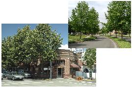
NATURAL ENVIRONMENT (SMP)
Future Vision for Redmond: Natural Environment
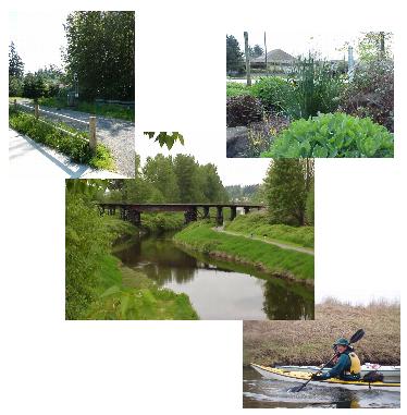
Redmond in 2022 has maintained a very green character. The City is framed within a beautiful natural setting, with open spaces and an abundance of trees continuing to define Redmond’s physical appearance. A system of interconnected open spaces provides habitat for a variety of wildlife. The City prides itself for its environmental stewardship, including an emphasis on sustainable land use and development patterns, landscaping that requires little watering, and other techniques to protect and conserve the natural environment, while flourishing as a successful Urban Center. Lake Sammamish and the Sammamish River, noted for their water quality, are used for boating, swimming and other types of recreation. Through many cooperative efforts, the improved water quality is demonstrated annually in the increasing salmon runs. Public access to shorelines has been enhanced while protecting the natural environment and property owners’ rights.
A. Environmental Stewardship
B. Environmentally Critical Areas
Critical Aquifer Recharge Areas
Water Quality and Basin Planning
C. Tree Preservation and Landscape Enhancement
D. Air Quality
E. Noise
F. Light Pollution
The Natural Environment Element implements the vision of Redmond as a city enriched with valued natural features that enhance the quality of life for the community. This element provides policies to maintain key natural processes and functions that provide the natural physical foundation for the community while acknowledging the need to accommodate growth.
The “green infrastructure” of the City provides the backbone on which physical development occurs. Key strategies to maintaining the City’s environmental assets are summarized below:
♦ Maintain a green infrastructure map to determine how all of the City’s environmental assets interact;
♦ Work actively to address informational gaps in the environmental network;
♦ Use a science-based approach to ensure no net loss of critical areas’ significant ecological functions;
♦ Maintain and strive to enhance a healthy natural ecosystem;
♦ Monitor and report on the effectiveness of Redmond’s environmental protection programs, policies, and regulations;
♦ Foster a high quality of life by retaining trees, promoting clean air, limiting noise and light pollution, and maintaining scenic vistas; and
♦ Strive towards becoming a sustainable community.
A. Environmental Stewardship
The environmental stewardship policies address the need to consider the long-range implications of City policies upon the environment, to conduct City operations in a manner that protects the environment, and to provide education on how the City, its businesses, and residents can improve the quality of the environment.
Consider the immediate, long range and cumulative environmental impacts of policy, regulatory and service decisions. Consider these impacts in the context of the City’s commitment to provide for the public safety, public facilities and services, a high quality of life, and economic vitality in a sustainable environment.
Utilize Best Management Practices (BMPs) and technology in City projects and practices to achieve effective environmental stewardship while striving towards long-term fiscal responsibility.
Conduct City operations in a manner that provides quality municipal services to the community while encouraging resource conservation and minimizing adverse environmental impacts.
Minimize and, where practical, eliminate the release of substances into the air, water, soil and groundwater that may degrade the quality of these resources or contribute to global atmospheric changes.
Encourage the judicious use of renewable natural resources and conserve non-renewable resources.
Reduce waste, reuse and recycle materials, and dispose of all wastes in a safe and responsible manner.
Promote and lead education and involvement programs to raise public awareness of environmental issues, encourage respect for the environment and show how individual actions and the cumulative effects of a community’s actions can have significant effects on the environment.
Support sustainable development and strive towards becoming a sustainable community.
Encourage environmentally friendly construction practices such as the build green program and low-impact development.
Encourage projects which utilize alternative technologies, engineering, and plans which emphasize low-impact development strategies through incentives and flexibility in application of regulatory requirements.
Environmental issues often extend beyond governmental boundaries. Cooperation between governments is essential to address many environmental problems. Redmond should continue its policy of working cooperatively with others to address environmental issues.
Cooperate with other local governments, State, federal and international agencies and non-profit organizations to protect and enhance the environment, especially for issues that affect areas beyond Redmond’s boundaries.
B. Environmentally Critical Areas
The environmentally critical areas policies provide for the protection of designated critical areas identified in the Growth Management Act. This includes Fish and Wildlife Habitat Conservation Areas, wetlands, Frequently Flooded Areas, Critical Aquifer Recharge Areas, and Geologically Hazardous Areas.
Environmentally critical areas are important contributors to Redmond’s high quality of life. Some natural features are critical to protect because of the hazards they present to public health and safety, some because of the values they represent. Those that present a hazard are protected to prevent loss of property and human life caused by inappropriate development in these areas. Other critical areas are protected to preserve and maintain their ecological functions, and the quality of life and livability for humans. Some species, such as salmon, are considered keystone species and are a commonly used as benchmark indicators of overall environmental health of a region.
Science plays a central role in delineating critical areas, identifying functions and values, and identifying protection strategies. The State’s Best Available Science (BAS) Rule requires the integration of science into the establishment and update of critical areas ordinances.
Use Best Available Science to preserve and enhance the functions and values of critical areas through policies, regulations, programs, and incentives.
Implement an adaptive management program based on Best Available Science to revise policies, regulations, and programs as needed to reflect changes in scientific advancement and local circumstances.
Use science-based mitigation to offset unavoidable adverse impacts to critical areas.
Implement monitoring and adaptive management programs for critical areas mitigation projects to ensure that the intended functions are retained and, when required, enhanced over time.
Use the precautionary principle when there is an absence of valid scientific information or incomplete scientific information accompanying a development application. Limit development and land uses activities until the uncertainty is sufficiently resolved.
One of the best opportunities to protect critical areas while allowing an appropriate level of development is to avoid development in critical areas. Another way of protecting critical areas while providing for appropriate levels of development is to focus development on the areas of the site best suited to development while leaving critical areas undeveloped, through clustering or density transfers.
Conserve and protect environmentally critical areas from loss or degradation. Maintain as open space hazardous areas and significant areas of steep slopes, undeveloped shorelines and wetlands.
Allow modification of critical areas where they have low ecological value and the function and values will be fully replaced. Avoid land uses and developments that are incompatible with environmentally critical areas.
Avoid, where possible, the creation of new parcels with buildings sites entirely within wetlands, streams, steep slopes, Frequently Flooded Areas and their associated buffers where possible. Configure future parcels to have a building site outside of these areas.
Encourage use of creative and appropriate site design and housing types to balance environmental protection and achievable density. Encourage Planned Residential Developments (PRDs), Planned Commercial Developments (PCDs), clustering, and density transfers for both commercial and residential development to help retain significant natural features and critical areas as open space.
While protection of critical areas is important to the Redmond community, allowing all properties some reasonable economic use also is important. This policy does not guarantee that each property will be able to be used for its theoretically highest and best use or that all portions of a property can be used for development. Rather, the policy provides that the critical areas regulations be administered so that each property has some economic use.
Ensure critical area regulations provide some reasonable economic use for all property within Redmond when taking into account the entire property.
Consistency between jurisdictions can help citizens and the development community work more efficiently with sensitive areas regulations. While local variations need to be accommodated, the local governments in King County are committed to making critical areas regulations more consistent.
Work cooperatively with other jurisdictions in King County to develop and implement critical area regulations, designations, and education programs that meet the goals of the Redmond community and provide for optimal consistency among jurisdictions.
Geologic hazards include areas susceptible to erosion, sliding, earthquake, or other geologic events. They pose a threat to health and safety to citizens when incompatible residential and non-residential development is sited in areas of significant hazards.
Erosion hazard is a measure of the susceptibility of an area of land to prevailing agents of erosion. Factors such as grain-size, soil cohesion, slope gradient, rainfall frequency and intensity, surface composition and permeability, and the type of cover help determine the severity of the erosion hazard. Erosion Hazard Areas are those areas where there is a severe hazard.
Landslide Hazard Areas are potentially subject to significant or severe risk landslides based on a combination of geologic, topographic, and hydrologic factors. Examples of Landslide Hazard Areas include areas of historic failures; areas designated as such on maps published by the United States Geologic Survey; areas containing slopes steeper than 15 percent; springs or groundwater seepage, and hillside intersecting geologic contacts with a relatively permeable sediment overlying a relatively impermeable sediment or bedrock; slopes that are parallel or subparallel to planes of weakness in subsurface materials; areas potentially unstable as a result of rapid stream incision or stream bank erosion; and any area with a slope greater than 40 percent.
Seismic Hazard Areas are those areas subject to severe risk of damage as a result of earthquake induced ground shaking, slope failure, settlement, soil liquefaction, surface faulting, or subsidence and uplift. “Severe risk of damage” is loosely defined as damage that is structural rather than cosmetic. Because of its geologic structure and history of earthquake activity, the region has been designated as a Class III seismic risk zone, the highest rating given by the United States Geologic Survey.
Avoid and/or minimize potential impacts to life and property from geologic hazards such that the site is rendered as safe as one not containing such hazard.
Require appropriate levels of study and analysis as a condition to permitting construction within Geologically Hazardous Areas, ensure sound engineering principles are used based on the associated risk in these areas, and appropriately limit land uses in areas of Geologically Hazardous Areas.
Strictly limit disturbance in Landslide Hazard Areas.
Direct uses that require substantial improvements, clearing and grading, or structures away from Geologically Hazardous Areas.
Manage development in Erosion Hazard Areas to minimize erosion during both construction and use.
Promote soils stability by the use of natural drainage systems and retention of existing vegetation in Geologically Hazardous Areas.
Promote sound development practices, including Best Management Practices (BMPs), to limit erosion and sedimentation during construction.
Establish setbacks around the perimeter of site-specific Landslide Hazard Areas to avoid the potential to undermine these areas, cause erosion and sedimentation problems to downstream or downhill land uses and avoid the risk to human life and safety.
Require that construction, maintenance, and operation of development in Seismic Hazard Areas minimizes hazards to persons, property, and natural resources within the Seismic Hazard Area and the entire community.
Require site-specific seismic hazard preparedness studies for essential public facilities and lifelines.
Critical Aquifer Recharge Areas
A significant portion of the City’s water supply is obtained from wells. Once groundwater is contaminated it is difficult, costly, and sometimes impossible to clean up. Preventing contamination is necessary to avoid exorbitant costs, hardships, and potential physical harm to people.
Critical Aquifer Recharge Areas are areas where an aquifer used for drinking water is both highly susceptible and vulnerable to contamination from surface activities. An aquifer is a sizable and continuous body of porous material composed of sand, gravel or silt saturated with water and capable of producing usable quantities of water to a well. As required by federal law, this water is monitored and tested to ensure that it meets the high standards required for drinking water.
The risk of groundwater contamination depends on two main sets of conditions. One set of conditions relates to the ground itself and how easy it is for water to pass through to groundwater. This is what is meant by hydrologic susceptibility. The other set of conditions relate to how likely it is for potential contaminants to reach groundwater. This is known as contaminant loading potential or source loading. Vulnerability is the combined effect of these two conditions.
Protect the quality of groundwater used for public water supplies to ensure adequate sources of potable water for Redmond and the region. Ensure that the level of protection provided corresponds with the potential for contaminating the municipal water supply aquifer.
Ensure degradation of groundwater quality does not occur.
Prohibit discharge of wastewater and potentially contaminated stormwater to groundwater.
For water to be pumped on a sustainable basis, new water must enter the aquifer. The best available data indicates the aquifer is recharged by rain water infiltrating into the ground through permeable soils and by recharge from rivers, streams and lakes. Wetlands and natural areawide landscape depressions that allow water to stand also may aid in groundwater infiltration by slowing runoff and allowing it to seep into the ground when located in suitable areas. Development can lessen the water entering the aquifer by covering recharge areas with impervious surfaces or filling wetlands and natural depressions that contain standing water. Important groundwater recharge areas that are planned for rural or natural resource uses should be retained in these uses. These areas include the northern Sammamish Valley and the Bear Creek and Evans Creek Valleys.
Retain aquifer recharge capacity in areas that have not already been committed to urban uses.
In urbanized areas, maintaining open space, areas of natural vegetation and wetlands also can help recharge aquifers. Many developments include some open spaces or recreation areas. By siting these areas on lands with the highest potential for groundwater recharge they can do double duty, providing both aesthetic and recreational functions and groundwater recharge. These areas must be carefully located to minimize the potential for contaminated water to enter the aquifer.
Encourage retention of open spaces, tree protection areas and other areas of protected native vegetation with a high potential for groundwater recharge and which can be protected from contaminated stormwater runoff.
Hazardous material cleanups also have the potential to protect and improve ground and surface water quality. State and federal programs require that certain properties contaminated with hazardous materials be cleaned up. In addition, many property owners voluntarily cleanup contaminated land. Redmond does not have many contaminated sites, but the City should encourage cleanups. Redmond also should work with property owners and State and federal agencies to ensure that sites that may affect groundwater supplies are cleaned up thoroughly so they do not present a future threat to groundwater quality.
Encourage cleanup of contaminated sites within the City. To encourage such cleanups, ensure regulations and standards are performance based, do not duplicate State and federal requirements, and provide for expeditious approval where local review is required.
Clean up contaminated sites that may affect Redmond’s groundwater supplies to such a standard that the sites will not present a risk to drinking water supplies.
Frequently Flooded Areas are open channel and overbank areas within the 100-year floodplain that are frequently inundated with floodwater. Floodplains are generally flat, low-lying areas adjacent to rivers or streams that periodically flood during storm events. These areas move large volumes of water and debris downstream during storms.
The Federal Emergency Management Agency (FEMA) delineates flood hazards along major river and stream corridors to identify areas at risk from floodwater. This information is used for both floodplain management and insurance rating.
Flooding can damage structures in the floodplain. Persons living or working within a floodplain are at risk of injury from floods and the disease that can spread from flood waters.
Employ no net impact floodplain management to avoid impacts to both upstream and downstream properties.
Strive towards no net loss of the structure, value, and functions of natural systems constituting Frequently Flooded Areas.
Regulate development in the 100-year floodplain to avoid substantial risk and damage to public and private property and loss of life. Ensure these regulations, as a minimum, comply with State and federal requirements for floodplain regulations.
Direct uses that require substantial improvements or structures away from areas within the 100-year floodplain.
Locate public facilities outside of the 100-year floodplain unless needed to serve development within areas characterized by urban development or because efficiencies from locating near existing public facilities already within the 100-year floodplain would clearly outweigh the risk of damage to the facility.
Require that construction, maintenance, and operation of development in the 100-year floodplain minimizes hazards to persons and property within the 100-year floodplain and the entire community.
Update policies and development regulations to incorporate more detailed data on the extent of flood hazards as it becomes available.
Cooperate with flood hazard reduction planning carried out by King County and update policies and development regulations to incorporate appropriate recommendations from these studies.
Require compensatory floodplain storage for all projects constructed within the 100-year floodplain, except for Downtown development in the 100-year floodplain of the Sammamish River.
Include areas where compensatory floodplain storage is not required when the hydraulics and hydrology of the Sammamish River are reanalyzed.
As development occurs within a basin, the 100-year floodplain will expand, exposing some properties that were previously outside the floodplain to potential flood damage. These effects occur because as a basin develops the amount of impervious surfaces increase, increasing runoff and therefore flood depths. While the stormwater management policies in this element and in King County will reduce these effects, they will not prevent them entirely. One way of anticipating and responding to these changes is to identify the future-conditions floodplain. The future-conditions floodplain is the area that will be inundated by a 100-year flood when the basin is fully developed. FEMA flood hazard maps are based on current and historic conditions, not build-out. Additional work is needed to identify the future-conditions floodplain.
Include flood flow estimate representing future conditions build-out into the City’s floodplain regulations as it becomes available.
Consider reductions in the FEMA floodway only if future flows have been considered and adequately accommodated.
Properties outside the 100-year floodplain also can aggravate flooding and flood damages. Development in landslide or erosion prone areas can lead to the clogging of streams and drainage systems, increasing flooding within and outside the 100-year floodplain. As areas outside the 100-year floodplain develop, increased impervious surfaces may increase runoff during storms and thus increase flood heights within the 100-year floodplain and cause flooding outside the existing 100-year floodplain. Increased stormwater runoff can significantly impact salmon and steelhead habitat by literally washing it away. Reducing the amount of impervious surfaces and implementing stormwater detention can help reduce these impacts, but not eliminate them entirely.
Limit impervious surfaces outside the Downtown to reduce the possibility of flooding, to protect the environment, and to allow for groundwater recharge.
Explore new methods to limit impervious surface to protect environmental resources such as streams and allow for groundwater recharge, allow for efficient land use, and accommodate the level of development intensity planned for the area.
Clearing and grading for developments also can increase stormwater runoff by removing vegetation and organic soils that absorb rain water. Excessive erosion can be very damaging to water quality on adjacent and downstream waterbodies, including those that support salmonid fish and other fish species. To prevent these negative impacts, Redmond should continue to adopt and enforce clearing and grading requirements to minimize runoff and erosion.
Maintain and update clearing and grading regulations to minimize the overall impact of the activity on the environment. Generally, limit clearing to the parts of site that will be developed.
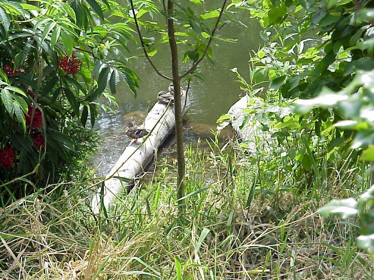
Wetlands are areas that are inundated by ground or surface water frequently enough to support vegetation typically adapted to live in saturated soils. They perform many ecological functions, including flood control, reductions of erosion and siltation, water storage, groundwater recharge, water quality maintenance, nutrient absorption, and fish and wildlife habitat. Additionally, wetlands provide opportunities for research and scientific study, outdoor education, and open space.
Wetlands can be hazardous areas to develop. Their organic soils are generally poorly suited for development and may not support foundations, streets or utilities.
It is the City’s goal to achieve no net loss of wetlands through retention of function, value, and acreage of wetlands. Mitigation sequencing is used to ensure impacts to wetlands are avoided, where possible, and mitigated, when necessary.
Preserve wetlands to achieve no net loss of wetlands function and value. Use size and value of the wetlands to determine the amount of development allowed, if any. Seek to maintain wetlands acreage over the long-term.
Require buffers adjacent to wetlands to protect the ecological functions integral to healthy wetland ecosystems.
Use federal mitigation sequencing guidelines when reviewing projects impacting wetlands. This involves, in the following order: avoiding the impact altogether by not taking a certain action or parts of actions; minimizing the impact by limiting the degree or magnitude of the action and its implementation; rectifying the impact by repairing, rehabilitating or restoring the effected environment; reducing or eliminating the impact over time by preservation and maintenance operations during the life of the action; and compensating for the impact by replacing or providing substitute resources or environments.
Ensure the amount of mitigation required reflects the value and function of the wetlands affected by the project, the risk that the mitigation may fail, the temporal loss of wetlands functions and values, the spatial locations of the mitigation and the difficulty of replacing many wetlands functions and values. For these reasons, require in general a significantly larger area of mitigation than the area of wetlands impacted.
Pursue opportunities to enhance and restore degraded wetlands.
Implement effective ways of wetland mitigation such as mitigation banking for capital improvements projects that are linear, such as road and utility projects.
Water Quality and Basin Planning
Development in the watersheds of rivers, streams and lakes must be carefully managed to retain water quality and prevent flooding.
Water Resources Inventory Area 8 represents the salmon recovery planning area of the Lake Washington/Cedar/Sammamish watershed. Chinook salmon are listed as threatened under the Endangered Species Act. In WRIA 8, citizens, scientists, businesses, environmentalists and governments are cooperating on protection and restoration projects and on developing a science-based plan to conserve salmon today and for future generations. Funding for the salmon conservation plan is provided by the 27 local governments, including Redmond, in the watershed.
Maintain surface water quality meeting State and federal standards over the long term. Restore surface water that has become degraded to provide for fish, wildlife, plants, and environmentally conscious human use of the water body.
Restore and protect the biological health and diversity of Water Resource Inventory Area (WRIA) 8 within the City.
Work with regional agencies to monitor surface water quality and implement measures to identify and address any sources of contamination.
Control the flow of nutrients (especially phosphorus), heavy metals and other pollutants into streams, rivers, Lake Sammamish and other area lakes, and natural wetlands. Require treatment measures where the development results in discharges to surface or groundwaters.
The Puget Sound Water Quality Plan encourages the preparation of basin plans to address water quality issues for all watersheds that drain to Puget Sound, including the Sammamish River basin in which Redmond is located. The Puget Sound Water Quality Plan refers to these plans as Watershed Action Plans.
Cooperate with King County and other local governments and State agencies in developing and implementing Watershed Action Plans, Water Quality Management Plans, and other types of basin plans for basins which include or are upstream or downstream from the City of Redmond.
Complete and maintain Watershed Action Plans for all watersheds in the City. Address water quality, stormwater runoff and flooding issues. Review each plan for effectiveness at least once each five years.
Incorporate the applicable and effective recommendations of Watershed Action Plans (basin plans) into the City’s Comprehensive Plan, development regulations and Capital Facilities Plan.
The habitat in Redmond’s rivers, streams and lakes is important to protecting the area’s high quality of life, valuable aquatic resources, and the area’s natural beauty. The Sammamish River, with its trail and parks, is an important focal point for Redmond and ties the City into a regional recreational network. All of these areas are important to salmon migration.
Protect and enhance rivers, streams and lakes, including riparian and shoreline habitat, to protect water quality, reduce public costs, protect fish and wildlife habitat and prevent environmental degradation. Protect both perennial and intermittent streams to preserve natural hydraulic and ecological functions, fish and wildlife habitat, recreational resources and aesthetics.
Protect the near shore habitat of Lake Sammamish by avoiding bulkheads within the 100-year floodplain elevation.
Riparian corridors consist of vegetation along river and stream banks that are influenced by the surface waters. Ecological processes of riparian corridors include waterflow, sediment routing, vegetation succession, woody debris recruitment, and plant and animal speciation.
Avoid development impacts to riparian corridors. Protect riparian vegetation within stream buffers to maintain ecological functions. Enhance and rehabilitate these areas if they are impacted by development and encourage this when development takes place on adjacent uplands. Establish stream buffers to protect riparian ecological functions that contribute to healthy stream systems.
Preserve and enhance the natural appearance of stream corridors.
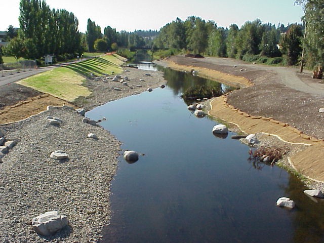
The Sammamish River and some area streams have been channelized and adversely impacted by other forms of development. Channelization reduces the habitat values of rivers and streams and increases the speed at which water flows through, potentially increasing downstream flooding. While it is not always possible to return these water bodies to their original condition, restoring rivers and streams can improve fish and wildlife habitat, environmental functions, recreational uses and aesthetics. It also can reduce flood damage.
Encourage restoration and enhancement of the Sammamish River, Lake Sammamish, riparian stream corridors, wetlands, and associated buffers with priority given to areas associated with listed species. Explore actively and pursue a variety of funding mechanisms for enhancement and restoration work.
Encourage improvements to the fisheries habitat of watercourses when abutting properties are developed.
Public education is an important component in efforts to protect surface and groundwaters. Surface and groundwater quality can be adversely affected by individual choices that people make regularly. Education can help residents and businesses choose options that meet their needs and desires while protecting surface and groundwater quality.
Support public education to protect and improve surface and groundwater resources by:
♦ Increasing the public’s awareness of potential impacts on water bodies and water quality;
♦ Encouraging proper gardening and farming practices including the use of environmentally appropriate fertilizers and chemicals;
♦ Encouraging proper disposal of materials;
♦ Educating businesses on surface and groundwater protection Best Management Practices in cooperation with other government agencies and other organizations; and
♦ Educating the public and businesses on how to substitute materials and practices with a low risk of surface and groundwater contamination for materials and practices with a high risk of contamination.
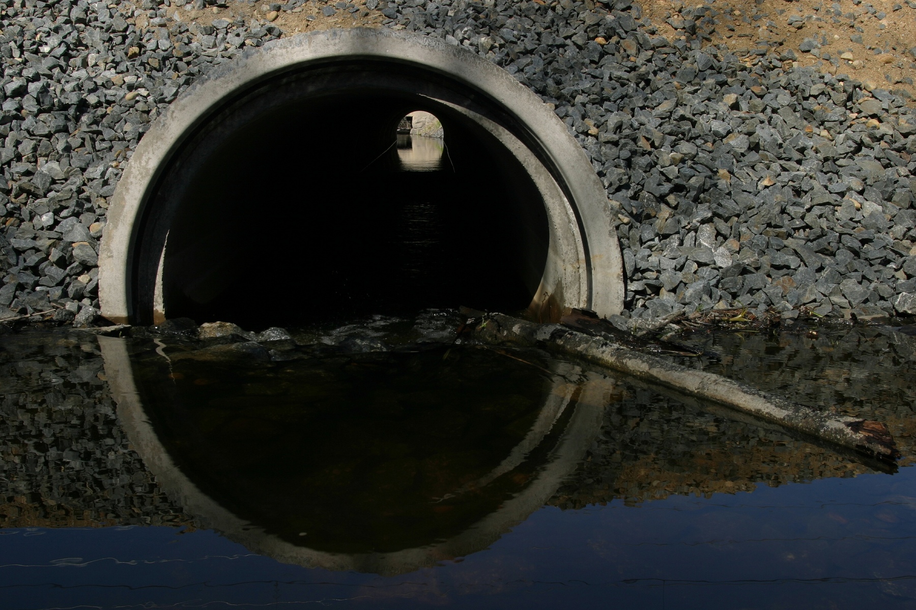
Natural drainage courses both within and outside the 100-year floodplain can function to lessen flood damages. Properly functioning natural streams and drainage ways include pools and overflow areas that slow stormwater runoff. Retaining natural drainage courses also helps to accommodate stormwater flows from upstream properties. Placing streams in culverts may not accommodate flood flows, reduces their value to fish and wildlife habitat, and may create barriers to fish passage.
Avoid alteration of riparian stream corridors to the maximum extent possible. Whenever possible, avoid reduction in the capacity of natural drainage courses and minimize enclosures of natural drainage ways. Discourage relocation. Replace and enhance the flood control and habitat values of drainage courses when relocation or alteration is necessary for public benefit. Require enhancement when alteration of a stream to increase the usability of a site is permitted.
Use bridges as the preferred method of crossing a watercourse that has habitat suitable for fish use or may be rehabilitated for fish use in the future. Prohibit the use of culverts where a fish barrier would result. Consider allowing culvert systems that would provide stream beds similar to natural channels where loss of habitat would not be significant and the cost of a bridge does not justify its benefits to fish passage, flood control or other resources.
Stabilize streambanks and shorelines, if necessary, by bioengineering techniques except where unique factors make this approach infeasible.
Restore natural drainage channels that have been placed within culverts and have had their capacity or habitat value reduced as development or redevelopment occurs. Allow retention of existing culverts for stream crossings where they do not result in a fish barrier in a stream that contains or has the potential to contain fisheries habitat.
Fish and wildlife enhance the quality of life of a community. The salmon and steelhead are enduring symbols of the Northwest. Birds are valued for their songs and appearance. Other wildlife is attractive and helps maintain the valued character of the area. Wildlife diversity is often an indicator of environmental health. There is growing evidence that people living in metropolitan areas are interested in wildlife. Wildlife provides for human recreation and relaxation and wildlife has aesthetic and education values. Studies have shown that viewing wildlife has aided in the recovery of sick people as it aids in the recovery of one’s mental health.
Under the Growth Management Act, Fish and Wildlife Habitat Conservation Areas include:
♦ Areas with which endangered, threatened, sensitive, and candidate species have a primary association;
♦ State priority habitats and areas associated with State Priority Species;
♦ Habitats and Species of Local Importance when designated by the City Council;
♦ Naturally occurring ponds under 20 acres and their submerged aquatic beds that provide fish or wildlife habitat;
♦ Waters of the State;
♦ Areas critical for habitat connectivity; and
♦ Aquatic areas such as rivers, steams, lakes, ponds, and wetlands.
Wildlife habitats are characterized by a variety of internal (site specific) and external (contextual) habitat conditions. Internal conditions include: structural diversity (horizontally and vertically) of habitat; edge conditions; presence of snags or large trees; presence of downed logs; and presence or nearness of water and its safe accessibility. External conditions include: the size of the habitat patch; ability of the habitat to serve as a corridor or link to otherwise isolated natural areas, parks, preserves, or open spaces; the area is surrounded by a buffer or serves as a buffer; and the surrounding habitat types or land uses.
Maintain a rich ecosystem supporting a variety of wildlife as well as opportunities for education and appreciation of native habitats.
The central planning concept for wildlife habitat in urban environments is to create an integration of habitat reserves and interconnecting corridors. Habitat reserves are generally considered to be areas of differing sizes that meet the basic needs of wildlife. Corridors are regarded as narrow, linear strips of habitat that have wildlife value. The corridors serve as interconnecting links between or along the habitat reserves.
Many of the critical lands conserved offer wildlife habitat as well, but riparian systems and streams are especially important. Natural riparian corridors are essential for wild fish populations. Reduced large woody debris is deemed a major reason for salmonid decline in Pacific Northwest streams. Healthy Riparian zones are dynamic ecosystems that perform various functions that form salmonid habitat. Some of the major functions include:
♦ Producing and delivering large and small woody debris to shorelines and stream channels;
♦ Shoreline streambank protection and habitat formation;
♦ Removing sediments and dissolved chemicals from water;
♦ Moderating water temperature;
♦ Providing favorable microclimate (humidity, temperature, and wind speed);
♦ Providing habitat for terrestrial animals;
♦ Providing proper nutrient sources for aquatic life;
♦ Allowing exchange of water between the ground and the waterbody;
♦ Providing flux of gravel between stream beds and banks; and
♦ Providing light patterning which salmonids use for concealment.
Core Preservation Areas form the backbone of the habitat areas within the City. These areas are already protected through other regulatory mechanisms. They include Native Growth Protection Easements, Class I streams and their buffers, and Class II through IV streams and other areas similarly protected. The Core Preservation Area includes wetlands and streams and their associated buffers as they become identified at a site-specific level.
Quality Habitat Areas provide significant wildlife value by virtue of their characteristics. These characteristics include several parameters indicative of habitat quality, including size, community diversity, interspersion (spatial patterns), continuity, forest vegetation layers, forest age, and invasive plants.
Protect Core Preservation Areas within the City.
Restore and enhance degraded or lower quality habitat within Core Preservation Areas.
Pursue opportunities to preserve Quality Habitat Areas especially those which extend and connect to Core Preservation Areas.
Design developments, parks, and recreation areas to minimize impact to, and retain the character of, Quality Habitat Areas.
Species protection is identified and accomplished during a site-specific study. Development is regulated through a series of management recommendations. Species protection applies to Species of Concern, Priority Species, and Species of Local Importance. Species of Concern includes those federally and State listed endangered, threatened, sensitive, or candidate, as well as those species listed or proposed for listing by the federal government.
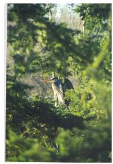
Heron – Species of Local Importance
Protect natural resources having a primary association with Species of Concern, Priority Species, and Species of Local Importance.
Participate in regional efforts to recover species listed under the Endangered Species Act (ESA).
Develop and implement local response plans, policies, and programs to protect Redmond’s wildlife targeting recovery of ESA listed species.
Modify City plans, programs, and policies such as public projects, private development standards, maintenance standards, and utility practices to be consistent with regional and local ESA policies and requirements.
Protect salmon, steelhead and other fish, plants and wildlife that rely on the aquatic environment by protecting and improving water quality.
Give special consideration to conservation and protection measures to preserve and enhance anadromous fisheries.
As a community develops, the available wildlife habitats become separated from each other. In part, this is a natural consequence of the development of urban areas. This is called habitat fragmentation. Where sections of critical habitat are linked, populations can move between the habitat areas. This lessens the dangers of interbreeding and allows plants and animals to recolonize the underused habitats.

Minimize habitat fragmentation by linking wildlife habitats via corridors. Connect wildlife habitats with each other within the City and the region to achieve a continuous network. Wildlife corridors include, but are not limited to, parklands usable by wildlife, protected or reserved (Native Growth Protection Easements) open space, utility rights-of-way, riparian corridors, wetland buffers and protected sensitive areas.
Consider impacts City projects have on wildlife corridors and connectivity.
Many species of fish and wildlife are quite mobile and move from jurisdiction to jurisdiction during their life or with the seasons. This mobility requires a regional approach to their management.
Coordinate land use planning and management of fish and wildlife resources with other local governments within the region, affected State and federal agencies, and Native American Nations and Tribes.
It is important to monitor and manage urban wildlife habitats to maintain their integrity to numerous outside influences and managed landscapes surrounding them. A management strategy is needed for the maintenance of wildlife habitat.
Develop a wildlife habitat management strategy and well-defined goals to monitor and maintain wildlife habitat, with mechanisms for City and volunteer support.
Pesticides can kill birds and decimate prey populations of several City Priority Species. Usage of these substances to maintain City-owned rights-of-way, parklands, and public spaces should be discouraged.
Minimize impacts to wildlife and water quality by using organic fertilizers and organic pesticides as much as possible and by restricting use of inorganic fertilizers and inorganic pesticides in its daily operations. Implement public outreach and educational opportunities to inform residents of the impacts of pesticides on wildlife.
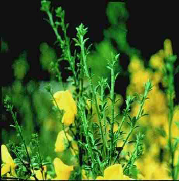
Weeds can be a problem because they are detrimental to wildlife by replacing native plant species and providing little to no value in terms of forage, cover or nest sites for the wildlife community. These weeds spread quickly from one area to another. Noxious weeds already adversely affect most habitat areas. Currently, the most prevalent problem weeds for wildlife in the City include blackberry species, Scot’s broom, reed canarygrass, English ivy, and holly.
Use native vegetation on City capital projects, prevent the continued spread of invasive and noxious weeds to habitat areas, maintain a long-term management strategy to prevent noxious weeds, and manage these weeds where they are present on City-owned properties.
Use a majority of native vegetation that is supportive of wildlife instead of non-native plant species and avoid the use of invasive species when landscaping for new developments adjacent to wildlife habitats.
Ensure management of noxious weeds and invasive species are an integral part of landscape plans for new development.
Non-regulatory measures are a key component of a comprehensive wildlife habitat management strategy. Several organizations have urban or backyard wildlife certification programs, including the National Wildlife Federation, the National Institute for Urban Wildlife, and the Washington Department of Fish and Wildlife. The National Institute for Urban Wildlife will certify city parks as urban wildlife sanctuaries when certain criteria are met. The National Wildlife Federation can certify a city as a Community Wildlife Habitat.
Promote public education and outreach on wildlife habitat in the City and provide information to residents on how they can participate in the Backyard Wildlife Sanctuary Program.
City certification as a Community Wildlife Habitat involves the entire community. This designation may include certified backyard sites, certified school sites, a public demonstration garden, participation by the business community, and related projects such as wildlife surveys, sensitive areas mapping, and creation of wildlife corridors.
Support urban wildlife habitat management through education, City actions, and demonstration projects.
Education is a key non-regulatory component towards embracing wildlife habitat management. Wildlife habitat restoration and demonstration projects show residents how habitat can be created or improved in their own backyard. Restoration projects need not be limited to plant installations. Other features important to wildlife can be added to the habitat area depending upon site conditions. These features can include nest boxes, bat boxes, snags, brush piles, ponds, reptile and amphibian mounds, and other constructed and natural features. Habitat enhancement efforts need not be expensive. Limiting mowing to heavily used areas and allowing grassy meadows to grow along forest edges and in other low intensity use areas can provide additional habitat for numerous wildlife species. Rotational mowing can increase habitat value for some species.
Employ wildlife habitat friendly practices in designing and maintaining City parks.
King County has a Native Plant Salvage Program. County staff and volunteers salvage native understory plants on sites where development plans have been approved. The plant material is kept at a holding facility. Plants are typically used on County volunteer projects.
Coordinate with King County’s Native Plant Salvage Program to facilitate the identification of potential sites for plant salvage.
C. Tree Preservation and Landscape Enhancement
The Tree Preservation and Landscape Enhancement policies address the value of protecting trees and enhancing the placement of trees within the City.
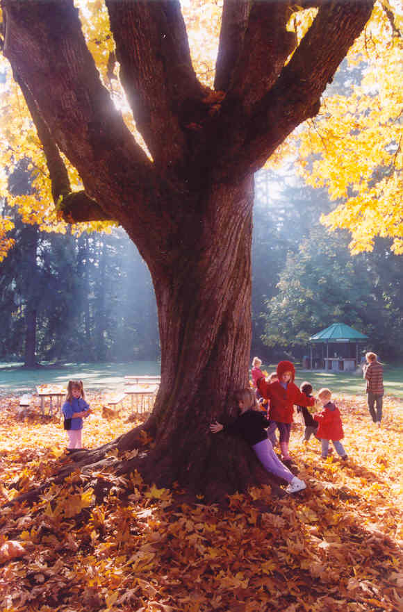
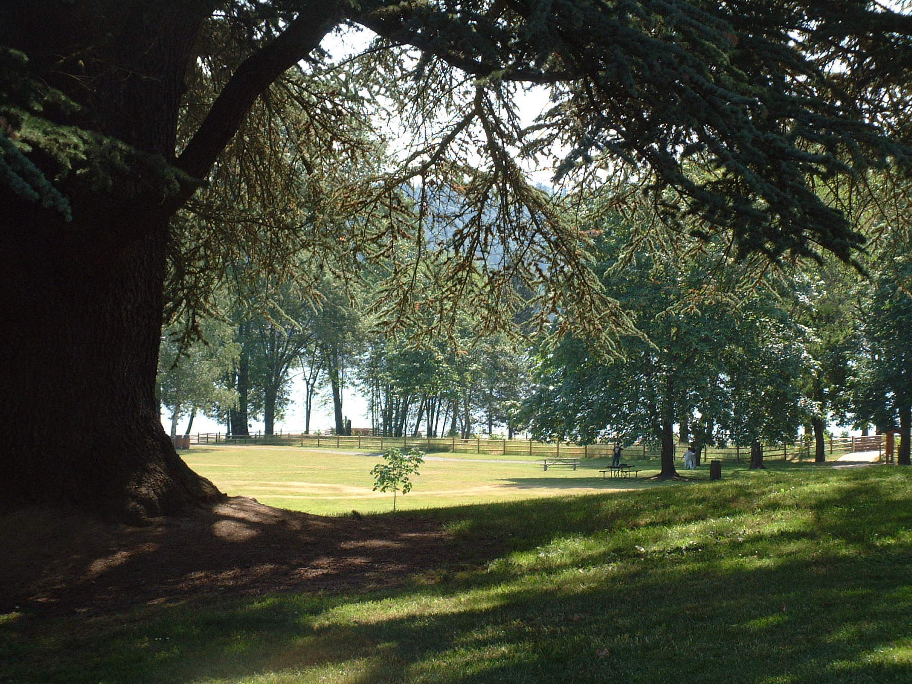
Trees aid in stabilizing the environment’s ecological balance by helping to purify the air, generating oxygen, slowing and absorbing stormwater runoff, stabilizing slopes, reducing erosion, masking noise, containing glare and conserving energy. They enhance the community’s appearance, identity and natural beauty. Trees also provide habitat for birds and animals.
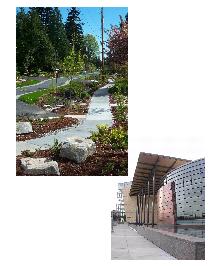
Preserve the natural environment and Redmond’s forested appearance.
Maintain no net loss of significant trees within the City over the long term.
Maximize tree retention and a treed appearance when development occurs through the following:
♦ Require the retention of viable tree clusters, forested slopes, treed gullies and specimen trees that are of species that are long-lived, not dangerous, well-shaped to shield wind and located so that they can survive within a development without other nearby trees.
♦ Design and construct developments to retain these trees.
♦ Identify and protect these trees during land divisions and site plan review.
♦ Allow removal of other trees to provide for project construction.
♦ Plant replacement trees on appropriate areas of the site to replace significant trees removed during construction.
Design City capital improvement projects to preserve trees to the maximum extent possible.
Some areas, such as gullies and steep slopes, are poorly suited for development because of their natural limitations and potential hazards. They typically are also expensive to serve with public facilities. These areas often include significant numbers of trees. If these areas are designated for low intensity uses by the Comprehensive Plan, potential negative impacts on the community from developing these hazardous areas can be prevented and trees retained. This can help the property owners as well. By matching the Comprehensive Plan designation to the suitability of the land, expensive measures that try to compensate for these natural limitations and try to serve intense uses with the needed infrastructure are avoided. These areas retain their character and are sensitively developed, making them valuable sites for appropriate uses.
Implement Comprehensive Plan designations and zoning for forested slopes and treed gullies consistent with the goal of retaining tree cover in these areas.
Trees along waterways, wetlands and lakes provide many important functions. Along streams and rivers, trees shade the water, which reduces temperatures in the summer and helps salmon, steelhead and other fish to survive. Trees in gullies and along streams help slow stormwater and reduce erosion. The root systems of trees can also help stabilize streams, reducing erosion and stream migration. Leaves and insects falling from trees into streams, wetlands and lakes provide important food sources for fish and other aquatic creatures. The trees also provide habitats for birds and animals.
Preserve trees within stream, wetlands, and their associated buffers, and lake building setbacks.
Plant suitable native trees and native vegetation within degraded stream, wetlands and lake buffers. Encourage planting suitable native trees and native vegetation within steep slopes.
Street trees provide an important visual amenity to the community. They provide a unifying look within diverse areas of the City and integrate buildings with each other and the landscape. Street trees help to develop a sense of place. Many streets are remembered because of their trees. Street trees also shade streets and parking areas in summer, reducing temperatures and building cooling loads conserving energy.
Require street trees along all arterial streets and along local streets designated in neighborhood policies. Where street trees are not practical, consider designating areas through neighborhood policies where trees will be required to be planted on developable lots.
Plant street trees in planter strips or tree wells located between the curb and any sidewalk where feasible. Select tree species and planting techniques to create a unified image for the street, provide an effective canopy, avoid sidewalk and utility damage and minimize water consumption. Require deciduous shade trees that are well suited to the climate and to planting along streets and sidewalks.
Another method of encouraging trees in the City is to make it easy for property owners to plant trees on their property or in planting strips adjacent to their property. Over the years, these voluntary efforts can result in many trees in the community. Maintaining lists of suitable trees, telling Redmond residents how to find good locations for trees and informing Redmond residents how to have underground utilities located so they will not be damaged during tree planting can help encourage community members to plant trees on their own.
Provide information to community residents and property owners to encourage them to plant trees on their properties.
Ensuring that Redmond remains a City with many trees requires that they be managed and maintained. The City maintains street trees in many areas. Property owners also must properly maintain trees to provide for their future.
Maintain and enhance a street tree maintenance program on arterial streets and City-owned trees.
Establish private maintenance provisions for the trees that will be retained within developments.
D. Air Quality
Clean air quality contributes to the quality of life. Clean air is healthful and it helps to keep the mountains, Lake Sammamish, Sammamish River and other areas visible from many areas in Redmond. These are views that the community values. Continued federal funding for transportation improvements is dependent on complying with federal air quality standards.
While other agencies regulate air quality, Redmond and other cities have an important role to play in maintaining high air quality. This includes transportation planning to reduce emissions and land use planning to internalize trips and reduce emissions.
Promote compliance with federal and State air pollution control laws and improvements to regional air quality in cooperation with the Puget Sound Air Pollution Control Agency and the Puget Sound Regional Council.
Maintain high air quality through land use and transportation planning and management.
Continue implementing and enforcing commute trip reduction programs as a means to limit or reduce vehicle trips as a key strategy for reducing vehicle-related air pollution.
Reduce the amount of air-borne particulates through a street sweeping program, dust abatement on construction sites, covered loads of hauled materials, and other methods to reduce the dust sources.
E. Noise
Noise is a pollutant that can have significant negative impacts on human health. Excessive noise also makes neighborhoods less desirable places to live and can contribute to deterioration of those areas. The Washington State Department of Ecology has adopted noise standards, but does not enforce them. Redmond should continue to enforce noise regulations.
Maintain noise regulations to limit noise to levels that protect the public health and that allow residential, commercial and manufacturing areas to be used for their intended purposes. Provide flexibility in the regulations to allow construction at night when necessary to protect worker safety while maintaining the tranquility of the City.
Provide noise reduction and mitigation measures to reduce the noise and visual impacts of freeways and arterials on residential areas. Ensure the Washington State Department of Transportation provides appropriate levels of noise suppression when expanding or improving State highways.
Require buffering or other noise reduction and mitigation measures to reduce noise impacts from Commercial and Industrial zones on residential areas.
Assure that mixed-use developments are designed and operated to minimize noise impacts. Measures may include provisions controlling uses, design and construction measures, and timing requirements.
F. Light Pollution
Light Pollution policies address the protection of the community from excessive glare and promote the concept of “dark skies.”
Glare is strong, steady light that shines away from the area that is meant to be illuminated. Glare interferes with views and, in extreme cases, may interfere with the normal use of nearby properties. Inappropriate overhead lighting along the Sammamish River can interfere with the feeding and spawning activities of salmon and trout. Night lighting is an important safety feature and should be allowed, but lighting should be designed and directed to minimize glare.
Design and construct night lighting to minimize excessive glare and to avoid spill over onto nearby properties.
Minimize overhead lighting that would shine on the water surface of the Sammamish River. Encourage the use of pedestrian level or shaded lighting when providing lighting along the river.
The “dark skies” policy seeks to reduce glare and maintain views of stars and planets. Redmond recognizes that night lighting is needed, but seeks to maintain dark skies in the residential and semi-rural areas of the community.
Encourage dark night skies in Redmond’s residential neighborhoods, in the Sammamish Valley, in the Bear Creek Valley, and over Lake Sammamish in development regulations, design standards, and development review.