Division 13-10-002
Street Design
Sections:
13-10-002-0001 Street Design
13-10-002-0001 Street Design
Street design shall:
A. Provide for appropriate continuation of existing and proposed arterial and collector streets and bikeways in accordance with the most recently adopted version of the Regional Plan and Division 13-10-014.
B. Provide sufficient rights-of-way for local service or a frontage street along major highways, or other treatment by separation to protect residential properties along arterial and collector streets.
C. Correlate with the drainage facilities when streets are used for on-site local drainage.
D. Be designed so that through traffic in residential districts is carried on arterial and collector streets. Residential subdivisions shall be designed so that the local streets provide vehicular, bicycle, and pedestrian access to the residences and services of the homes fronting the streets. Table 13-10-002-01 identifies the application of the different street cross sections, which are based on the total traffic volumes of the street.
1. In order to provide neighborhoods that are safe, functional, and express an atmosphere of community, subdivisions shall be designed so that the residential local streets carry volumes no greater than one thousand (1,000) ADT. When the traffic volumes on a given street exceed one thousand (1,000) ADT, it shall only provide access to a local street and not to residential properties. In those instances, the typical street section used shall be a minor collector as follows: The section will exclude the center left turn lane (left turn lanes will be required as needed where the minor collector intersects another collector or arterial street).
|
URBAN |
|||||||
|---|---|---|---|---|---|---|---|
|
Functional Classification(*) |
Major Arterial |
Minor Arterial |
Major Collector |
Minor Collector |
Commercial Local |
Residential Local "Wide" |
Residential Local |
|
Max. Through Lanes |
4 |
4 |
4 |
2 |
2 |
2 |
2 |
|
Maximum Average Daily Traffic |
|
|
|
|
|
1,000 |
500 |
|
On-Street Parking |
Not allowed |
Not allowed |
Not allowed |
Not allowed |
Not allowed |
Not striped |
Not striped |
|
Bicycle Provision |
4.5' |
4.5' |
4.5' |
4.5' |
In travel lane |
In travel lane |
In travel lane |
|
Total A.C. Width |
68' |
68' |
**68'/64' |
42' |
24' |
33' |
29' |
|
Width (B.C. to B.C.) |
72' |
72' |
**72'/68' |
46' |
28' |
37' |
33' |
|
Minimum R.O.W. (See Note No. 2) |
98' |
98' |
**96'/92' |
70' |
52' |
61' |
57' |
|
Through Lane Width |
12' |
12' |
12'≥40 mph 11'<40 mph |
11' |
12' |
NA |
NA |
|
Auxiliary Lane Widths |
11' |
11' |
11' |
11' |
NA |
NA |
NA |
|
Edge Treatments |
Vertical C/G |
Vert. C/G |
Vert. C/G |
Vert. C/G |
Vert. C/G |
Vert. C/G |
Vert. C/G *** |
|
Min. Sidewalks (See Note No. 3) |
6' |
6' |
5' |
5' |
5' |
5' |
5' |
|
Min. Parkway (See Note No. 8) |
5' |
5' |
5' |
5' |
5' |
5' |
5' |
|
Parking Lane |
Not allowed |
Not allowed |
Not allowed |
Not allowed |
Not allowed |
Not striped |
Not striped |
|
Minimum Median Width (See Note No. 7) |
15' |
15' |
15' |
NA |
NA |
NA |
NA |
|
Max. A.C. Width @ Signal w/o Median |
68' |
68' |
68' |
68' |
NA |
NA |
NA |
|
Max. A.C. Width at Nonsignalized Inters. w/o Median |
48' |
48' |
48' |
48' |
NA |
NA |
NA |
|
Corner Cut-Off (See Note No. 4) |
25' |
25' |
20' |
15' |
15' |
15' |
15' |
|
Curb Ret. Radius |
30' |
30' |
25' ** |
20' ** |
20' |
15' |
15' |
|
Design Speed |
45 MPH |
40 MPH |
35 – 40 MPH |
30 MPH |
25 MPH |
20 MPH |
20 MPH |
|
Superelevation (See Note No. 5) |
4% Max. |
4% Max. |
4% Max. |
None |
None |
None |
None |
|
Min. Curve Radius (See Note No. 5) |
900' |
667' |
667' (40 mph) 454' (35 mph) |
300' |
181' |
100' |
100' |
|
Maximum Grade |
6% |
6% |
6%/7% |
8% |
10% |
10% |
10% |
|
Property Access (See Note No. 6) |
Major D/W Only |
Major D/W Only |
Major or Combined D/W Only |
Individual D/W Head Out |
Individual D/W Head Out |
Individual D/W Back Out |
Individual D/W Back Out |
* Functional classifications are further defined in Division 13-10-014.
** 1. For travel lanes adjacent to a raised median, increase travel lane width by one (1) foot.
2. For all truck routes, there shall be a minimum through lane width of twelve (12) feet and a thirty (30) foot curb return radius at intersections.
*** Roll curb is permitted on streets in townhome and planned options where lot widths are less than or equal to forty (40) feet. This is limited to those streets within the development that front the houses.
Roll curb is permitted on residential cul-de-sacs per Engineering Standard Detail 10-04-010 in order to meet ADA requirements for maximum sidewalk cross slope at driveway entrances.
|
URBAN |
|||||
|---|---|---|---|---|---|
|
COMMERCIAL CENTER STREETS |
|||||
|
Functional Classification (*) |
Major Arterial |
Minor Arterial |
Major Collector |
Minor Collector |
Local |
|
Max. Through Lanes |
4 |
4 |
4 |
2 |
2 |
|
On-Street Parking |
6' |
6' |
6' |
6' |
6' |
|
Bicycle Provision |
5' |
5' |
5' |
5' |
In travel lane |
|
Total A.C. Width |
81' |
81' |
81'/77' |
55' |
36' |
|
Width (B.C. to B.C.) |
85' |
85' |
85'/81' |
59' |
40' |
|
Minimum R.O.W. (See Note No. 2) |
117' |
113' |
113'/109' |
87' |
68' |
|
Through Lane Width (**) |
12' |
12' |
12'≥40mph 11'<40mph |
11' |
12' |
|
Auxiliary Lane Widths |
11' |
11' |
11' |
11' |
11' |
|
Edge Treatment |
Vert. C/G |
Vert. C/G |
Vert. C/G |
Vert. C/G |
Vert. C/G |
|
Min. Sidewalks |
10' |
10' |
10' |
10' |
10' |
|
Furnishing Strip |
5' |
3' |
3' |
3' |
3' |
|
Offset |
1' |
1' |
1' |
1' |
1' |
|
Parking Lane |
6' |
6' |
6' |
6' |
6' |
|
Minimum Median Width (See Note No. 7) |
15'=11' lane + 4' median |
15' |
15' |
NA |
NA |
|
Max. Number of Lanes at a Signal w/o Median |
6 |
6 |
6 |
6 |
NA |
|
Max. Number of Lanes at a Nonsignalized Intersection w/o Median |
4 |
4 |
4 |
4 |
NA |
|
Corner Cut-Off (See Note No. 4) |
25' |
25' |
25' |
15' |
15' |
|
Curb Ret. Radius |
30' |
30' |
20' ** |
20' ** |
25' |
|
Design Speed |
45 MPH |
40 MPH |
35 – 40 MPH |
30 MPH |
25 MPH |
|
Superelevation (See Note No. 5) |
4% Max. |
4% Max. |
4% Max. |
None |
None |
|
Min. Curve Radius (See Note No. 5) |
900' |
667' |
667' (40 mph) 454' (35 mph) |
300' |
181' |
|
Maximum Grade |
6% |
6% |
6%/7% |
8% |
10% |
|
Property Access |
Major D/W Only |
Major D/W Only |
Major or Combined D/W Only |
Individual D/W Head Out |
Individual D/W Back Out |
* Functional classifications are further defined in Division 13-10-014.
** 1. For travel lanes adjacent to a raised median, increase travel lane width by one (1) foot.
2. For all truck routes, there shall be a minimum through lane width of twelve (12) feet and a thirty (30) foot curb return radius at intersections.
|
RURAL |
||||||
|---|---|---|---|---|---|---|
|
Functional Classification (*) |
Major Arterial (See Note No. 3) |
Minor Arterial (See Note No. 3) |
Major Collector (See Note No. 1) |
Minor Collector (See Note No. 1) |
Local |
Local Narrow |
|
Max. Through Lanes |
2 |
2 |
2 |
2 |
2 |
2 |
|
On-Street Parking |
Not allowed |
Not allowed |
Not allowed |
Not allowed |
Not striped |
Not striped |
|
Bicycle Provision |
4' |
4' |
4' |
4' |
In travel lane |
In travel lane |
|
Total A.C. Width |
32' |
32' |
32' |
30' |
26' |
20' |
|
Minimum R.O.W. (See Note No. 2) |
60' |
60' |
60' |
60' |
50' |
44' |
|
Through Lane Width (**) |
12' |
12' |
12' |
12' |
13' |
10' |
|
Edge Treatment |
6-Foot Compacted Shoulders and Drainage Swales/Curb and Gutter Is Optional (See Note No. 9) |
|||||
|
Sidewalks |
No Sidewalks or Parkway Section |
|||||
|
Parking Lane |
Not allowed |
Not allowed |
Not allowed |
Not allowed |
N/A |
N/A |
|
Corner Cut-Off |
30' |
30' |
20' |
20' |
20' |
20' |
|
Fillet Radius |
30' |
30' |
20' ** |
20' ** |
20' |
20' |
|
Design Speed |
45 MPH |
40 MPH |
35 – 40 MPH |
30 MPH |
20 MPH |
20 MPH |
|
Superelevation (See Note No. 5) |
4% Max. |
4% Max. |
4% Max. |
None |
None |
None |
|
Min. Curve Radius (See Note No. 5) |
900' |
667' |
667' (40 mph) 454' (35 mph) |
300' |
100' |
100' |
|
Maximum Grade |
6% |
6% |
7% |
8% |
10% |
10% |
|
Property Access |
Major D/W Only |
Major or Combined D/W Only |
Major or Combined D/W |
Individual D/W Head Out |
Individual Back Out |
Individual Back Out |
|
Min. D/W to Intersection |
(See Note No. 10) |
(See Note No. 10) |
(See Note No. 10) |
(See Note No. 10) |
10' |
10' |
* Functional classifications are further defined in Division 13-10-014.
** 1. For travel lanes adjacent to a raised median, increase travel lane width by one (1) foot.
2. For all truck routes, there shall be a minimum through lane width of twelve (12) feet and a thirty (30) foot curb return radius at intersections.
NOTES:
1. Rural residential local streets are for local access in lower density residential areas only. They provide a less intrusive design option for streets which will experience low traffic volumes and no on-street parking. Critical to their successful operation is a site design that eliminates virtually all demand for on-street parking by providing large setbacks, long driveways, and many convenient on-site parking spaces for each dwelling.
The following minimum development criteria shall be met for the rural residential local streets:
Cluster and Single-Family Detached Development – The rural residential local street shall be used where the minimum lot size is twenty-five thousand (25,000) square feet. The rural residential local "narrow" street shall be used where the minimum lot size is one (1) acre.
2. Additional right-of-way and/or easements may be required to accommodate turn lanes, traffic signals at intersections, drainage features, etc.
3. Sidewalks wider than five (5) feet may be required if high volumes of pedestrian traffic are expected, or in order to match existing adjacent sidewalks and master development plans.
4. The corner cut-off is normally a straight diagonal right-of-way line. A circular arc of this radius may be used if approved by the City Engineer.
At the intersection of two (2) streets of different classifications, the corner cut-off dimension and the curb return or fillet radius of the higher classification street shall be used.
5. For arterial and major collector streets, the relationship between superelevation rate, runoff, and curve radius shall be determined from AASHTO tables for e-max equals four percent (4.0%). For local streets, the minimum delta angle (D) shall be greater than thirty (30) degrees. Minimum curve radii in the table are based on no superelevation.
6. Pavement edge tapers shall be designed in accordance with City of Flagstaff Detail No. 10-10-031.
7. Medians shall be required on all arterials and major collectors and as outlined, or as required by the City Engineer.
8. Where new sidewalk is required in an existing development, the City Engineer may waive the requirement of a parkway if it is not practical to construct.
9. Where two (2) local residential "narrow" streets do not intersect at a right angle, the radius of curb returns on the acute angles shall be twenty (20) feet.
10. See Section 13-10-006-0001 for location of driveways adjacent to intersections.
11. For design criteria not addressed in this table, refer to AASHTO.
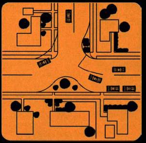
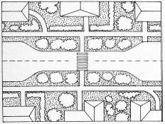
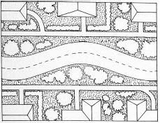
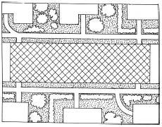
E. Require that new designs incorporate traffic calming techniques into all new residential streets. The goal is to reduce residential traffic speeds to within the design speed limits, while maintaining safe and reasonable access for all intended normal traffic. In order to achieve this objective, the maximum length of a roadway section between speed control points shall be six hundred sixty (660) feet. A speed control point is defined as any one (1) of the following:
1. Any design condition that requires a complete stop such as the intersection of a local residential street with a collector or arterial street, or a "T" intersection between local streets. (Note: Stop sign control at the intersection between local streets does not qualify.)
2. A horizontal curve that does not exceed a radius of three hundred (300) feet and a corresponding delta of thirty (30) degrees minimum.
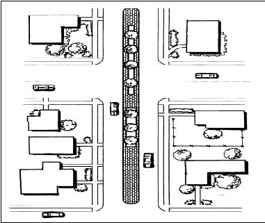
In the event that there are circumstances where it is not practical to achieve traffic calming measures with design features as stated above, Table 13-10-002-02 is intended to provide the design engineer with a list of alternative traffic calming design features (listed in order of preference).
|
Design Option |
Description |
Diagram |
Advantages |
Disadvantages |
|---|---|---|---|---|
|
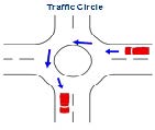
Neighborhood Traffic Circle |
Raised circular islands placed in intersections, around which traffic circulates. Typically, min. 14' diameter and includes 2-foot-wide mountable truck apron and landscaping |
|
a. Effective moderating speed
b. Improves safety
c. Located at intersections, the ability to calm two streets
d. Fixes grid that is adjacent
e. Aesthetic landscape opportunity |
a. Difficult for large trucks to circumnavigate
b. Designed such that the travel lane does not encroach upon crosswalks
c. May eliminate on-street parking
d. Maintenance
e. Larger trucks may have to violate lane to navigate |
|
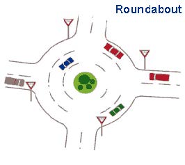
Roundabout a. Local to collector b. Local to arterial c. Permitted under special circumstances |
Larger than traffic circles and typically extends a minimum of 28' from center with 2' truck apron. The inscribed diameter should be 88' and 200'. Circulating roadway has a width of 14' to 19' |
|
a. Moderates traffic speeds on arterials
b. Enhanced safety as compared to signalization
c. Less operating expenses as compared to signalization |
a. May be difficult to navigate with large trucks
b. Designed such that the travel lanes do not encroach into crosswalks
c. Eliminates some on-street parking |
|
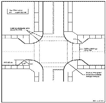
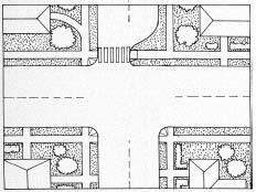
Curb Extension a. Swells
b. Elephant ears
c. Located at intersections only |
Comprises an angled narrowing of the roadway and widening of the sidewalk |
|
a. Improves pedestrian circulation and space
b. Through and left-turn movements are easily negotiable by large vehicles
c. Creates protected on-street parking bays
d. Reduces speeds, especially for right-turning vehicles |
a. Effectiveness is limited by the absence of vertical or horizontal deflection
b. May require the elimination of some on-street parking near the intersection
c. May require slow right-turning emergency vehicles
d. May require bicyclists to briefly merge with vehicular traffic
e. May create pedestrian conflict |
|
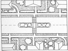
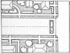
Center Island Narrowing |
A raised island located along the centerline of a street that narrows the travel lanes at that location. A min. of 6' x 20' and landscaped with pedestrian cut-through |
|
a. Increases pedestrian safety
b. Reduces traffic volume |
a. Speed reduction effect is limited by absence of any vertical and horizontal deflection
b. Eliminates some on-street parking
c. 300' to 500' spacing between center islands for smooth speeds |
|
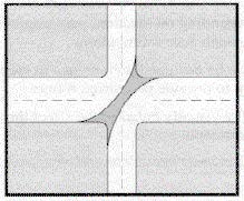
Realigned Intersection |
Changes in alignment that convert T-intersections with straight approaches into curving streets that meet at right angles |
|
a. Effective at reducing speeds and improving safety at T-intersections that have been ignored by motorists
b. Eliminates unnecessary pavement |
a. Curb realignment could be costly
b. May require additional right-of-way |
|
Choker |
Midblock curb extensions that narrow the street by expanding the sidewalk or adding a planting strip and often are installed at midblock crossings |
|
a. Easily negotiated by large vehicles
b. Reduces speed and volume |
a. Effect upon speed is limited by the presence of vertical and horizontal deflection
b. Bicycles briefly merge with traffic
c. Eliminates some on-street parking |
|
Chicane |
Literal shifts that alternate on both sides of the street creating an S-shaped path of travel |
|
a. Reduces speed through horizontal deflection
b. Larger vehicles can easily negotiate |
a. Designed to prevent drivers from varying from lane
b. Curb alignment and landscaping could be costly
c. Drainage a consideration
d. May eliminate some on-street parking
e. Snow plowing may be difficult to maneuver |
|
Textured Pavement |
A surface material on the roadway (such as stamped asphalt or concrete) which is installed to produce small, constant changes in vertical alignment |
|
a. Reduces speed over an extended length
b. Located at intersection, can reduce speeds on two streets |
a. Generally expensive due to material
b. Crosswalk application may cause difficulties for those with disabilities and cyclists to traverse
c. Less effective |
|
Truncated Diagonal Diverter |
A diagonal diverter with one end open to allow for additional turning movements |
|
a. Discourages commuter traffic by forcing turns |
a. Reduces local access
b. Displaces traffic to other streets
c. Costs |
|
One-Way, Two-Way |
Curb bulge or center island narrows 2-lane, forcing traffic for each direction to take turns |
|
a. Limited, rarely used |
a. Limited, rarely used |
|
Median Barriers (Applied at intersections in special circumstances) |
Intersection island blocking movement of a through street |
|
a. Improves safety at an intersection of a local street and a major street by prohibiting dangerous turning movements
b. Reduces traffic volumes on a cut-through route that intersects a major street |
a. Requires available street width on the major street
b. Limits turns to and from the side street for local residents and emergency services
c. Reduces access to driveways on major arterials |
|
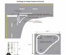
Pavement Markings Note: Applies only to retrofit of existing streets |
Painted striping or channelization to guide traffic |
|
a. Modestly affects speed |
a. Extreme unacceptable aesthetic |
|
Full Closures Note: Applies only to retrofit of existing streets |
Full closures divert traffic off the street, creating pedestrian and bicycle-friendly areas |
|
a. Maintains pedestrian and bicycle access
b. Effective in reducing traffic volume |
a. Causes circuitous routes for local residents and emergency service vehicles
b. May be expensive
c. May limit access to businesses
d. May increase volumes in remaining routes |
|
Half Closures Note: Applies only to retrofit of existing streets |
Similar to full closures, are barricades located in the street and constructed of landscaped walls, gates, side bollards, or other obstructions |
|
a. Maintains pedestrian and bicycle access
b. Effective in reducing traffic volume |
a. Causes circuitous routes for local residents and emergency service vehicles
b. May limit access to businesses
c. Depending on the design, drivers may be able to circumvent the barrier |
|
Diagonal Diverters Note: Applies only to retrofit of existing streets |
A barrier placed diagonally across an intersection disconnecting the legs of the intersection |
|
a. Does not require a closure per se, only a redirection of existing streets
b. Able to maintain full pedestrian and bicycle access
c. Reduces traffic volumes |
a. Cause circuitous routes for local residents and emergency service vehicles
b. May be expensive
c. May require reconstruction of corner curbs |
F. LID Integrated Management Practices (IMPs) as detailed in the City’s LID Guidance Manual as adopted as part of the City of Flagstaff Stormwater Management Design Manual may be allowed in the right-of-way on a case-by-case basis as approved by the City Engineer and Public Works section head.
Only stormwater generated in the public right-of-way will be allowed to be associated with an IMP. No stormwater generated on private property will be allowed to be associated with an IMP in the right-of-way.
LID IMPs, if allowed in the public right-of-way, shall be considered private drainage infrastructure. Ownership and maintenance responsibilities for LID IMPs shall be as described in the amendments to the Floodplain Management Regulations. (Ord. 2017-22, Rep&ReEn, 07/05/2017; Ord. 2024-13, Amended, 4/16/2024 (Res. 2024-15))


