3. HISTORICAL CONTEXT
The Norkirk Neighborhood is located near the traditional land of the First Peoples of Seattle, the Duwamish People. The Duwamish Tahb-tah-byook tribe once inhabited the Lake Washington shoreline of the Market Neighborhood from Juanita Bay to Yarrow Bay, as described in more detail in the Community Character Chapter of the Comprehensive Plan. Lake Washington and adjacent areas offered an abundance of riches, including wapatoes (a wetland tuber), tules, cedar roots, salmon, waterfowl, berries, deer, muskrat, beaver and otter. The 1855 Treaty of Point Elliott guaranteed hunting and fishing rights and reservations to all Tribes represented by the Native signers, including the Duwamish People. In return for the reservation and other benefits promised in the treaty by the United States government, the Duwamish People exchanged over 54,000 acres of its homeland. Today those 54,000 acres encompass much of present-day King County, including Kirkland (and the Norkirk Neighborhood). Unfortunately, the opening of the Lake Washington Ship Canal in the early 1900s also had a detrimental effect on the Duwamish People, lowering the level of the lake, affecting wetlands, and diminishing traditional food sources.

Congregational and Baptist Churches and Central School 1905. Arline Andre collection, Kirkland Heritage Society
The Norkirk Neighborhood is one of the most historic in the City of Kirkland. Norkirk has had a significant role in the development of the City starting in the late 1880s when most of the land was purchased to be part of Peter Kirk’s new town. The area around the present City Hall was the civic center of Kirkland in the 1900s. The churches were the community meeting places and the Kirkland Woman’s Club, the American Legion Hall and schools provided numerous community services. Central School was purchased by the City of Kirkland in 1977; it was vacated in 1978 and damaged by fire in 1980. The City of Kirkland reinforced Norkirk’s importance as the civic center of the City by building the new City Hall on the Central School site in 1982.
Homesteads in the 1880s
The land homesteaded in the 1880s by John DeMott and George Davey included most of the Norkirk Neighborhood and portions of downtown. These two homesteads extended from First Street to Sixth Street and from Kirkland Avenue up to 18th Avenue. The Carl Nelson and Martin Clarke Homesteads extended east of 6th Street up to 116th in the Highlands Neighborhood.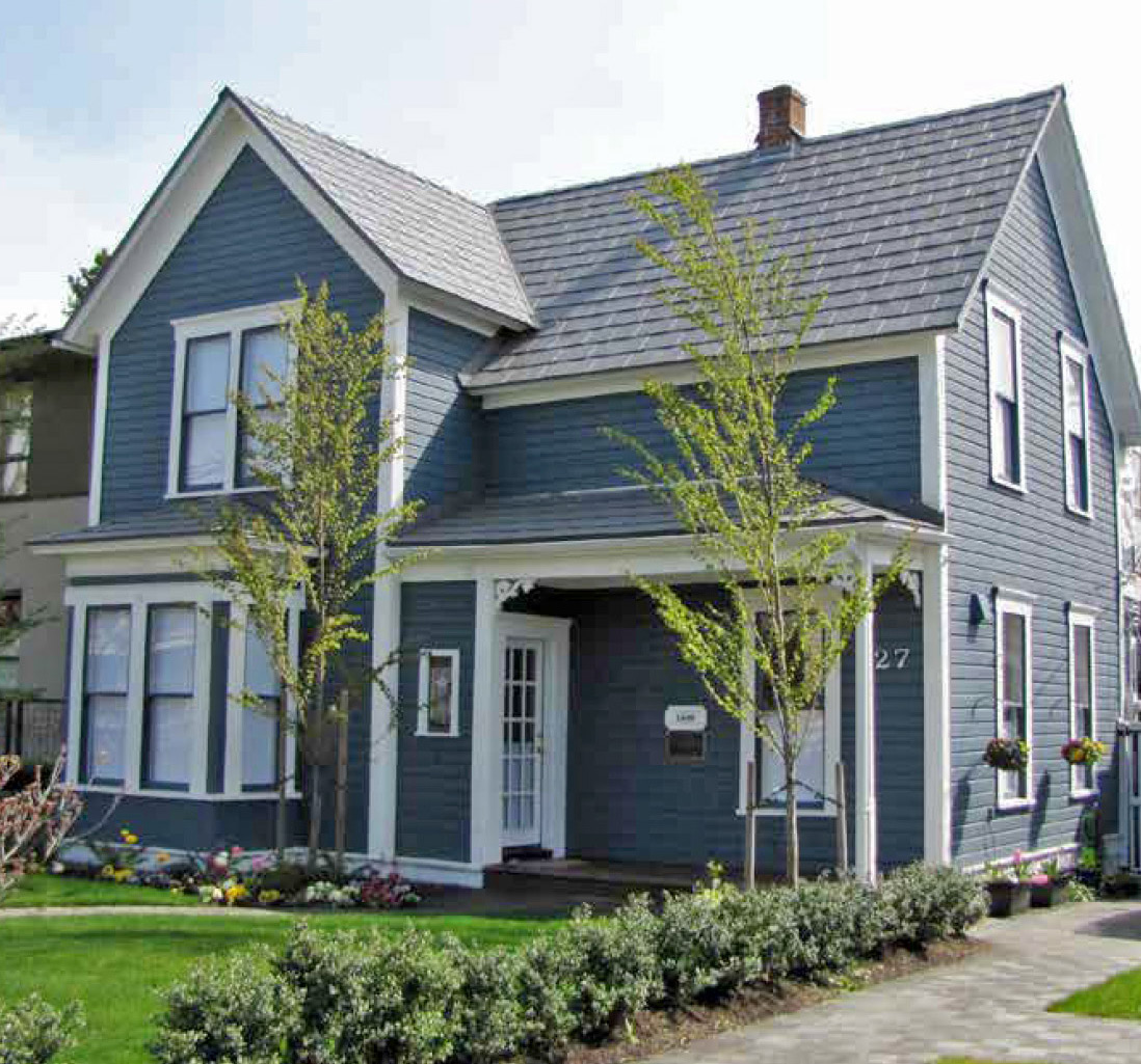
Buchanan historic home
The Norkirk Neighborhood was originally named Capitol Hill in 1888 and later likely changed to reflect references to “North Kirkland.” Norkirk was to have a significant role in Kirkland’s history, when 7th Avenue, then called Piccadilly, was the main road from Market to Peter Kirk’s Steel Mill on Rose Hill. The Kirkland Land and Improvement Company (KL&I) owned the land south of 9th Avenue (called Michigan until 1929). Joshua Montgomery Sears, one of the nation’s wealthiest men, owned the land from 9th Avenue up to 18th Avenue, between 1st Street and 6th Street. Sears privately owned one half of Kirkland, with the KL&I owning the other half. By 1892, 7th Avenue was lined with a medical facility operated out of a house (Buchanan House and now known as the Trueblood House, which was moved to 6th Avenue in 2017), several hotels, a livery, cleaners, and grocery stores. Churches and the first school were south of 7th Avenue.
Kirkland Land and Improvement Company
Between 1888 and 1890, Peter Kirk’s Kirkland Land and Improvement Company (KL&I) purchased many of the homesteads to begin the proposed new city, which would support the construction of the steel mill on Rose Hill near Forbes Lake. In 1890, the original plat was complete with the street layout much as we see it today – particularly from Market to 3rd Street and south of 10th Avenue. The town center was to be at the intersection of Market Street and Piccadilly (7th Avenue). Piccadilly, with its wide right-of-way, was the connecting road to the mill on Rose Hill.
In 1893 the nationwide depression wiped out Kirk’s dream of Kirkland becoming the “Pittsburgh of the West” as the financial backing stopped, and the mill closed without ever having produced steel. Very little development occurred in Kirkland until after 1910. Even though times were tough, the citizens voted to incorporate in 1905.
Boom Development 1910 – 1930: Burke and Farrar
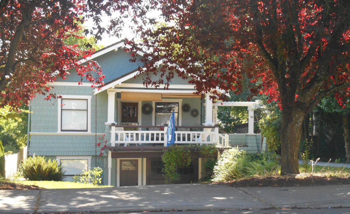
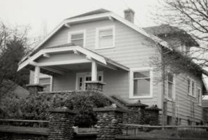
The most significant era of development in Norkirk was from 1910 through the 1930s after Burke and Farrar, Seattle developers, purchased the Kirkland Land and Improvement Company’s remaining holdings. The area north of 10th Avenue and east of 3rd Street was replatted in 1914 to better reflect the topography. This era coincided with the national popularity of the Arts and Crafts movement and the construction of bungalow and craftsman styles of homes. The Norkirk Neighborhood has the greatest number of bungalows in the City – it is very appropriate for the neighborhood association logo to reflect that time period and architectural style.
Van Aalst Park is on land once owned by John Van Aalst who had a bulb farm. Van Aalst bulbs were shipped all over the world from his 2.5 acre bulb farm. In 1915, Washington Film Works built a film plant between 4th and 5th Streets between 10th Avenue and 13th Avenue.
Railroad
The Northern Pacific Railroad line that formed much of the eastern boundary of the Norkirk Neighborhood was begun in 1903 and was completed in the summer of 1904. Acquired by the City in 2012, the railroad line was replaced with the multi-use Cross Kirkland Corridor.
Change of Street Names
In the late 1920s the street names defined in the original Kirk Plat were changed to the present numbering system to facilitate public safety. The street signs installed in 1999 and 2000 reflect the original historic names. For example: 3rd Street was Jersey Street; 6th Street was Orchard Street; 7th Avenue was Piccadilly Avenue; and 18th Avenue was Portland Avenue.
|
|
|
|
Representative photographs of Bungalows – Inventory Reports from Kirkland Heritage Society |
|
Naming of the Neighborhood
The name likely came from geographic references to “North Kirkland” relative to downtown. This was formalized with the naming of the Norkirk Elementary School in 1955.
Historic Properties
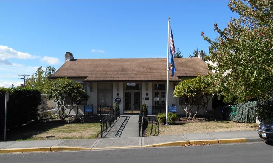
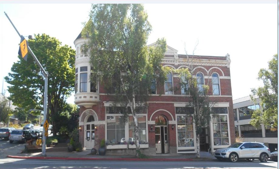
The Kirkland Heritage Society utilized a grant from the Kirkland City Council to conduct an inventory of properties meeting established historic criteria in 1999. The Norkirk Neighborhood had one-third of the buildings on the Citywide inventory. Twenty percent of the highest priority structures are in Norkirk. The Kirkland Woman’s Club, Trueblood House, Campbell Building and Peter Kirk Building are on the National and State Registers of Historic Places. The cluster of historic properties at the intersection of Market Street and 7th Avenue form an important historical link and entrance to the Norkirk Neighborhood. The Newberry House, Kirkland Cannery, Sessions Funeral Home, 5th Brick Building, the site of the former First Baptist Church/American Legion Hall, and the Houghton Church Bell are designated by the City of Kirkland as Community Landmarks. See the Community Character Element of the Comprehensive Plan for further historic resources information.
Policy N-1:
Encourage preservation of structures and locations that reflect the neighborhood’s heritage.
The following policies encourage preservation of structures and locations that reflect the neighborhood’s heritage.
Policy N-2:
Provide markers and interpretive information at historic sites.
Information identifying these important sites enables future community members to have a link with the history of the area both pre- and post-settlement. Attention should be given to celebrating the neighborhood’s history in an inclusive way, including by helping residents and visitors understand the history of the area prior to white settlement.
|
|
|
|
Woman’s Club and Peter Kirk Building – Recognized by City of Kirkland Inventory and Centennial Collections, Kirkland Heritage Society |
|
Policy N-3:
Continue to evaluate incentives to encourage retention of identified buildings of historic significance.
Flexibility in lot size requirements for lots that contain historic buildings is an incentive to preserve and protect historic resources. The Historic Preservation subdivision incentive allows lots containing historic buildings to be subdivided into smaller lots than would otherwise be permitted if the historic buildings meet designated criteria and are preserved on site. In the future, additional incentives may need to be explored to protect historic buildings. A particularly significant historic building in the neighborhood is the Kirkland Cannery. Located in the industrial area of Norkirk, some zoning flexibility to allow nonindustrial uses such as live/work lofts may be appropriate in order to preserve this building.
Policy N-4:
Conduct regular updates of the City’s historic building inventory to identify and designate new historic buildings that meet the established criteria.
The last inventory of historic properties was conducted in 1999. There may be buildings not included in the inventory that now meet the definition of historic resources. The City should periodically survey buildings in the neighborhood to identify those of historic significance. Historic places and features should be commemorated with signs or markers to help celebrate the history of the neighborhood. The inventory should be updated to include newly eligible properties according to the established criteria in the Community Character Element.


