4. NATURAL ENVIRONMENT
Policy N-5:
Protect and enhance the natural environment in the Norkirk Neighborhood.
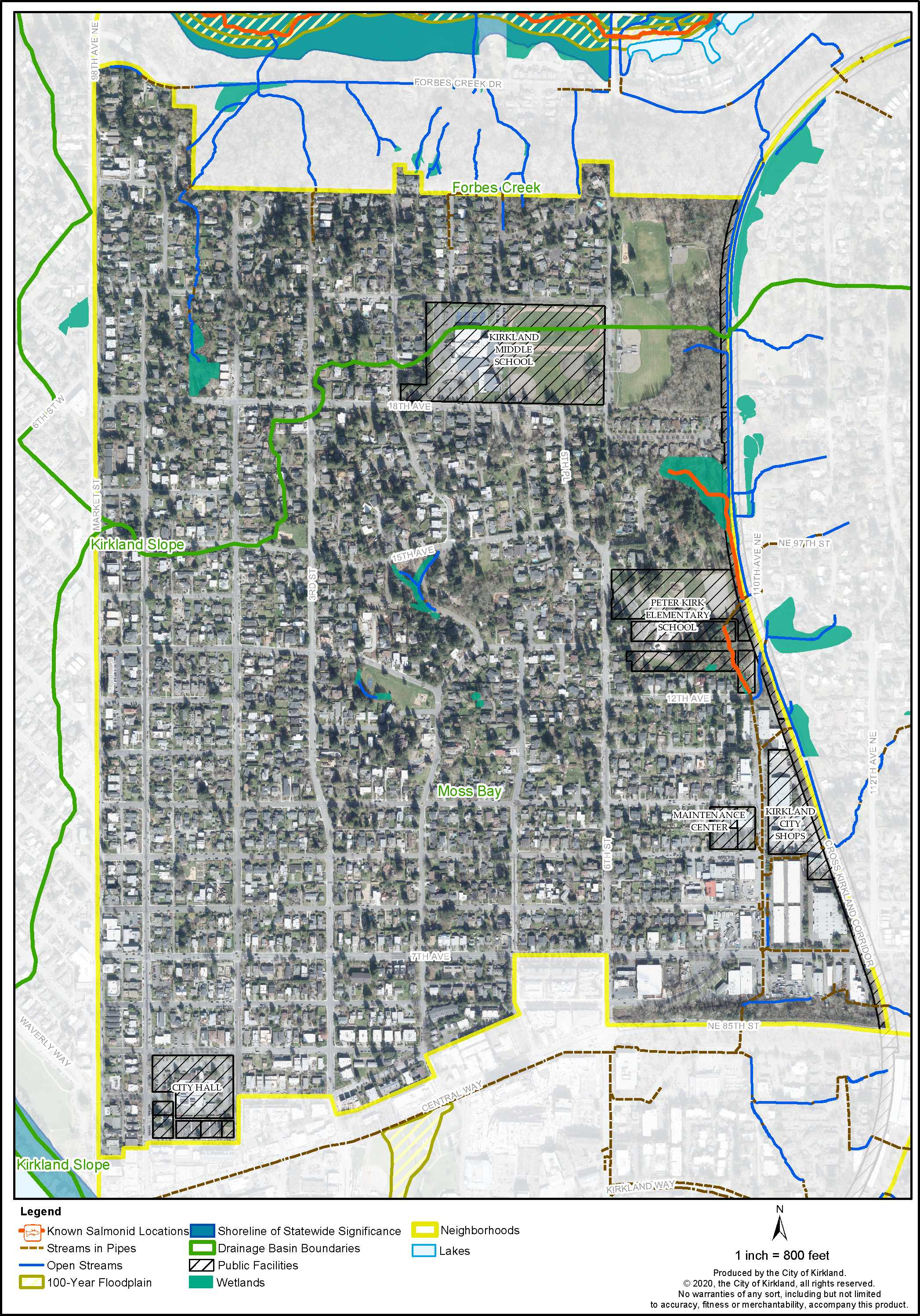
The environmental policies for the Norkirk Neighborhood strive to protect and enhance the quality of the natural environment as a natural amenity, to avoid potential environmental hazards, and to utilize sustainable management practices. The following map figures show the critical areas within the Norkirk Neighborhood. See the Natural Environment Element for more information about protection of wetlands, streams and associated buffers as well as landslide and seismic hazard areas, trees and wildlife. The Kirkland Zoning Code regulates tree retention, removal and development in critical areas.
Policy N-6:
Protect and improve the water quality and promote fish passage in the Forbes Creek and Moss Bay basins by undertaking measures to protect stream buffers and the ecological functions of streams, Lake Washington, wetlands and wildlife corridors.
The Norkirk Neighborhood is located within the Forbes Creek and Moss Bay drainage basins (Figure N-1). In the Forbes Creek basin, there is extensive cutthroat trout habitat in the main stem of Forbes Creek downstream of Forbes Lake. Coho salmon are found west of the freeway in Forbes Creek. The various Norkirk Neighborhood tributaries leading into the Creek contribute to the water quality downstream prior to entering Lake Washington. The Surface Water Master Plan guides the City’s efforts on water quality measures and projects. The small wetland and drainage area at Van Aalst Park provides an opportunity for enhancement on public property that could be accomplished as a neighborhood or school community service project.
Policy N-7:
Evaluate and consider opportunities to improve the function and quality of wetland and stream segments adjacent to the Cross Kirkland Corridor during implementation of the Cross Kirkland Corridor Master Plan.
In the Moss Bay drainage basin, the open stream portion of the Peter Kirk Elementary Tributary near the elementary school appears to have good water quality although analysis has not been conducted. It is suspected that water quality rapidly degrades through the piped network downstream prior to entering Lake Washington. In this tributary, removal of invasive species and revegetation of the area with native vegetation, including trees and shrubs, is worth investigating. Additionally, the feasibility of reintroduction of resident cutthroat trout into the stream and daylighting the piped portion of this tributary upon redevelopment of the industrial area are opportunities worth investigating. With the redevelopment of the Peter Kirk Elementary School, wetland restoration occurred in the northeast portion of the school property.
Policy N-8:
Develop viewpoints and interpretive information around streams and wetlands if protection of the natural features can be reasonably ensured.
Providing education about the locations, functions, and needs of critical areas will help protect these features from potentially negative impacts of nearby development and could increase public appreciation and stewardship of these areas. When appropriate, the placement of interpretive information and viewpoints will be determined at the time of development on private property or through public efforts on City-owned land.
Policy N-9:
Protect notable trees and groves of trees.
In the Norkirk Neighborhood, protecting, enhancing, and retaining healthy trees and vegetation are key values and contribute to the quality of life. The City promotes retention of the Citywide tree canopy, significant trees, and groves of trees on private property consistent with zoning regulations. While a municipal heritage or notable tree program is not currently in place, the neighborhood supports voluntary efforts to encourage preservation of heritage trees. Heritage trees are set apart from other trees by specific criteria such as outstanding age, size, and unique species, being one of a kind or very rare, an association with or contribution to a historical structure or district, or association with a noted person or historical event.
Geologically Hazardous Areas
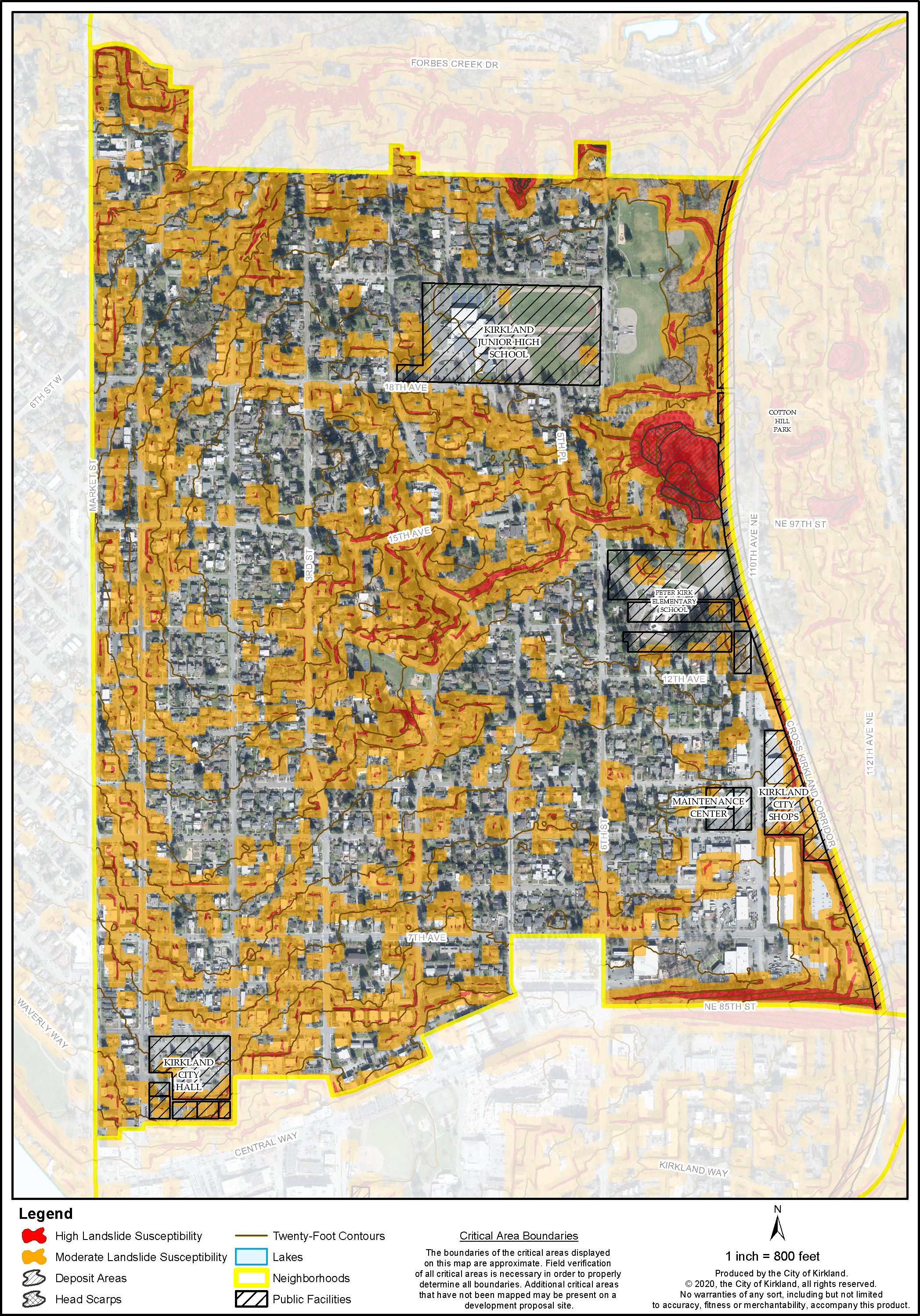
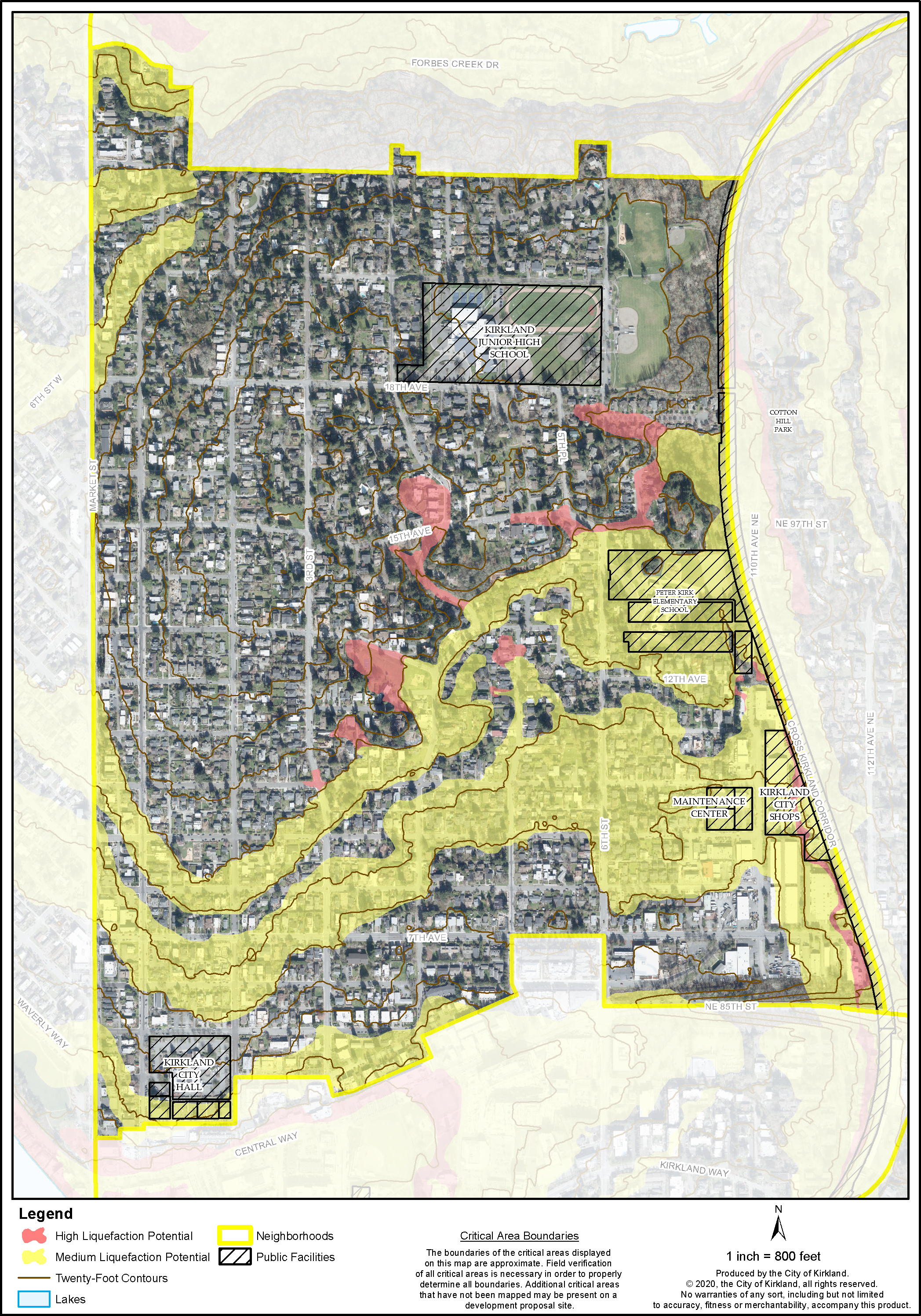
As shown in Figures N-2a and 2b, the Norkirk Neighborhood contains areas with steep slopes including potential for erosion, landslide hazards and soils with liquefaction potential during seismic events. Landslide hazard designated areas with development potential are primarily found north of Peter Kirk Elementary School near the Cross Kirkland Corridor (see Figure N-2). These areas are prone to landslides, which may be triggered by grading operations, land clearing, irrigation, or the load characteristics of buildings on hillsides. Development on geologically hazardous areas is governed by Zoning Code regulations.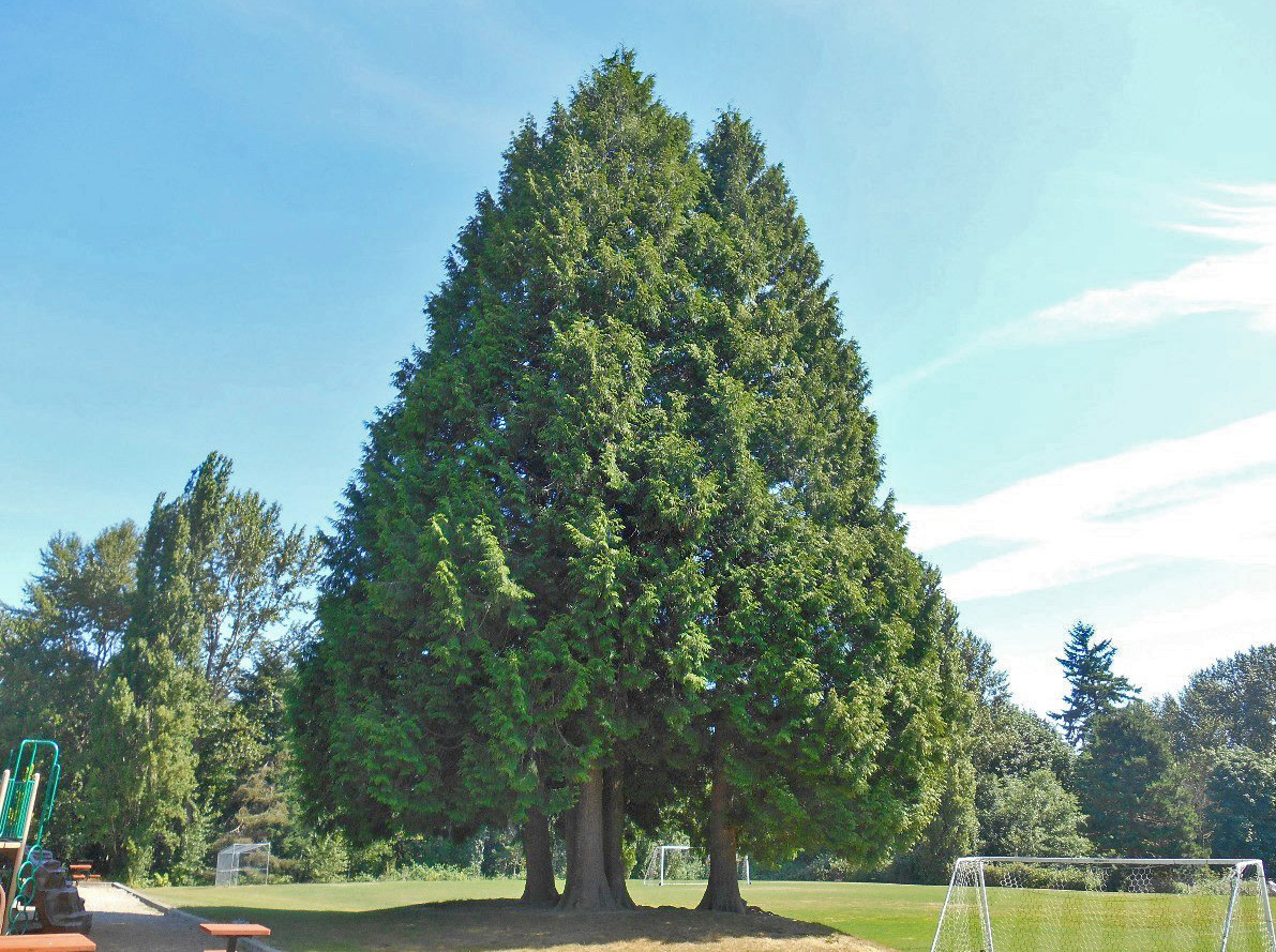
Trees at Crestwoods Park
Figure N-1: Norkirk Wetlands, Streams, and Lakes
Figure N-2a: Norkirk Landslide Susceptibility
Figure N-2b: Norkirk Liquefaction Potential
Policy N-10:
Avoid development of unimproved rights-of-way impacted by critical areas.
Those portions of 16th Avenue (east of 7th Street) that are found to have critical areas (geologically hazardous, wetlands, stream areas) should not be improved. A portion of unopened right-of-way is within a wetland area and should remain in its natural condition. Additionally, those portions of 20th Avenue that are found to be in medium and high landslide hazard areas should be analyzed to determine if street improvements can be safely made without significant impacts on the adjacent geologically hazardous areas or adjacent critical areas.
Policy N-11:
Protect wildlife throughout the neighborhood by encouraging creation of backyard sanctuaries for wildlife habitat in upland areas.
People in the neighborhood have opportunities to attract wildlife and improve wildlife habitat on their private property. These areas provide food, water, shelter, and space for wildlife. The City, the State of Washington Department of Fish and Wildlife, and other organizations and agencies experienced in wildlife habitat restoration can provide assistance and help organize volunteer projects.
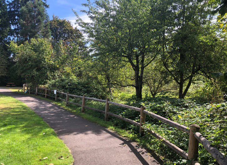
Natural Area park land includes forests, streams and wetlands


