5. LAND USE
The Norkirk Neighborhood contains diverse land uses that are successfully integrated into a historic, walkable block pattern. Churches and schools are dispersed throughout the residential core, while other public institutional uses such as Kirkland City Hall is in Planned Area 7 and the City Maintenance Center is in the industrial area of the neighborhood. Multifamily apartments and condominiums are in the southern portion of the neighborhood adjacent to the Central Business District. Retail, commercial, office, multifamily and mixed uses are focused in the Market Street Corridor and office, light industrial, and service commercial are concentrated in the light industrial zone at the southeast corner of Norkirk. For more information about the Market Street Corridor see the Market Street Corridor Plan Chapter of the Comprehensive Plan.
RESIDENTIAL
Policy N-12:
Retain and enhance the existing residential character of the Norkirk Neighborhood while accommodating more compact new housing, so that residents can age in place and the neighborhood can accommodate generational shifts in housing needs, and welcome new residents.
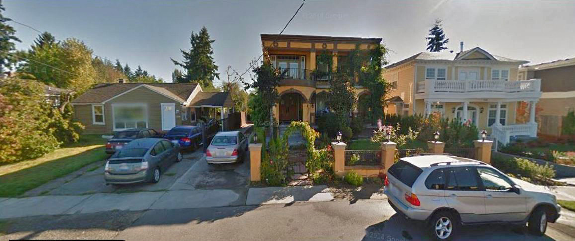
Norkirk is a well-established neighborhood that has a mix of old and new residential development located generally north of 7th Avenue. The land use transitions from the lower-intensity core to higher-intensity residential development at its south end. Preservation of the eclectic mix of housing styles and sizes is important to the neighborhood’s distinct character.

Norkirk’s innovative and eclectic design
Providing housing options for a wide spectrum of households is an important value to support and encourage. Innovative housing types including accessory dwelling units, duplexes, triplexes and cottages provide more housing choice to meet changing demographics such as smaller households. Rising housing prices throughout the City and region require strategies to promote lower cost housing. Allowing design innovations can help lower land and development costs and improve affordability.
Innovative development styles or techniques also enable increased protection of hazardous or critical areas. They can allow for more environmentally sensitive site planning by concentrating development on the most buildable portion of the site while preserving natural drainage, vegetation, and other natural features.
Compatibility of new housing and with older housing in the neighborhood is an important value for the neighborhood. Architectural and site design standards such as use of varied architectural styles, roof angles and proportional building mass to allow for substantial light and privacy between structures, tree retention, generous setbacks from the street, well maintained landscaping and limited off-street parking will ensure compatibility with adjacent existing housing. Innovative housing techniques and styles such as small lot single-family, historic preservation and low impact development subdivisions, cottage and common wall (duplex and triplex) homes, accessory dwelling units, clustered dwellings, and co-housing are appropriate options to serve a diverse population and changing household size and composition. They also help maintain the diversity of housing that characterizes Norkirk. Standards governing the siting and construction of alternative housing types in Norkirk should be consistent with Citywide zoning, development and subdivision regulations. New housing should enhance the historic residential character of the neighborhood, while meeting community need.
Policy N-13:
Allow lot sizes that match the existing lot size and development pattern.
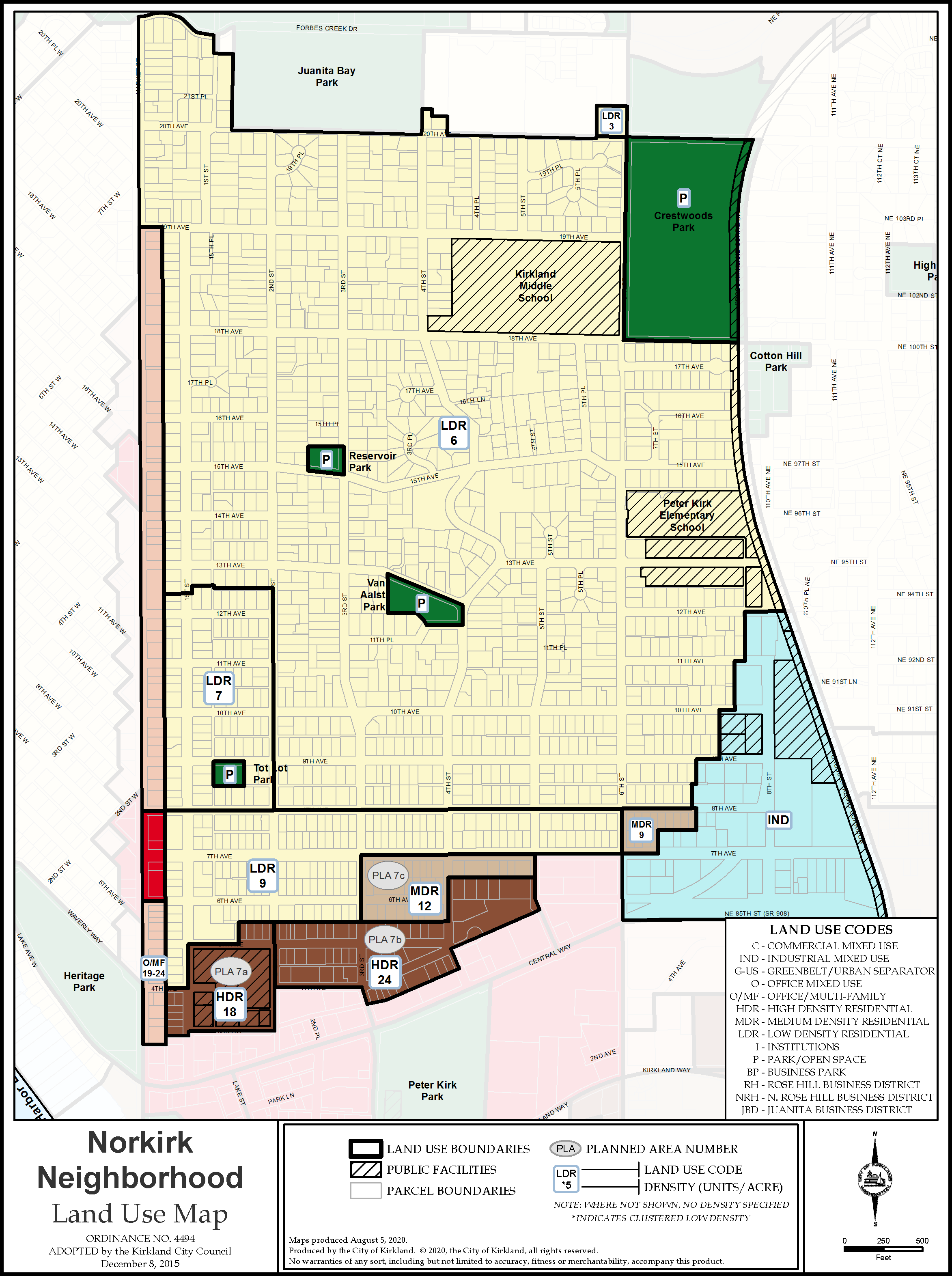
A limited area, bounded on the east by 2nd Street, on the west by the alley between Market and 1st Streets, on the south by 8th Avenue, and on the north by the alley between 12th and 13th Avenues, has a particularly large number of lots that are less than 7,200 square feet (see Figure N-3, Land Use Map). Seven dwelling units per acre, which is comparable to the Single-Family Residential (RS) 6.3 zoning classification (6,300 square feet minimum lot size), is a density that is consistent with the existing platting pattern here. Similarly, small sized lots should be allowed in proximity to these smaller lots to be consistent with the lot pattern and to provide more housing capacity and home ownership opportunities.
Figure N-3: Norkirk Land Use Map
PLANNED AREA 7
Policy N-14:
Maintain effective transitional uses between the downtown and the low-density residential core of the neighborhood.
Planned Area 7 (PLA 7) is a transition zone between the low-density residential core of the neighborhood and the downtown.
Policy N-15:
Allow a range of residential densities in Planned Area 7.
A slope separates this area from commercial development in the downtown. Multifamily residential structures as well as institutional uses such as Kirkland City Hall are appropriate here. Three subareas within PLA 7 allow a hierarchy of increasing densities approaching the Central Business District (CBD). Future development throughout PLA 7 should be compatible with the scale of structures in adjacent lower intensity residential zones while accommodating a range of compact housing types suitable for a variety of households.
COMMERCIAL
Policy N-16:
Focus commercial development in established commercial areas in the Market Street Corridor at the west boundary of the Norkirk Neighborhood.
Commercial development should remain in established commercial areas within the Market Street Corridor and not extend into the residential core of the neighborhood or north of 19th Avenue. A slope and alley parallel to Market Street provide a topographic and manmade transition between the Market Street Corridor and the residential core of the neighborhood. Similarly, a slope running parallel to Central Way provides a topographic transition between commercial development in the downtown and residential development in Planned Area 7. Commercial development is prohibited in low-, medium-, or high-density residential areas.
|
|
|
|
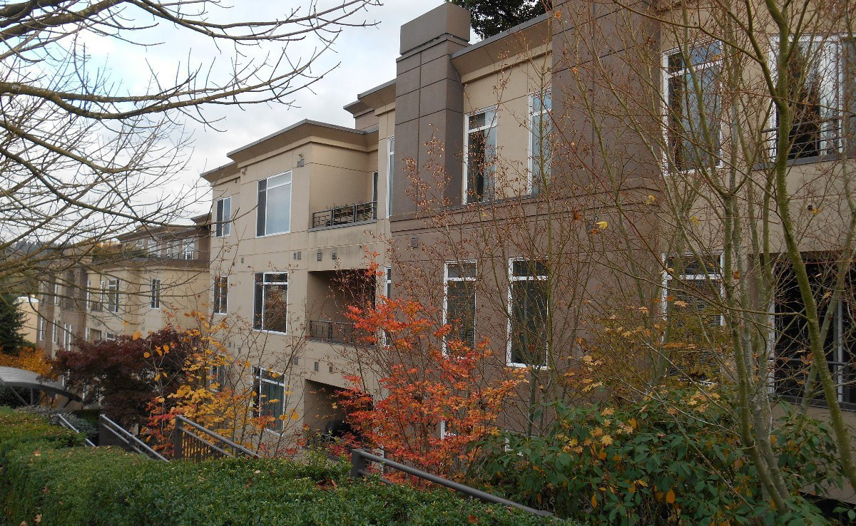
Condominiums on 4th Avenue and 2nd Street and Kirkland City Hall at 123 5th Avenue |
|
Policy N-17:
Coordinate planning for the Norkirk Neighborhood with the goals and policies found in the Market Street Corridor section of the Comprehensive Plan.
The western boundary of the Norkirk Neighborhood is in the middle of Market Street. The Market Street Corridor is shared with the Market Neighborhood. It is important for both neighborhood plans to be coordinated with the subarea plan for the corridor.
INDUSTRIAL
Policy N-18:
Maintain the light industrial area to serve the needs of the community.
The Norkirk Light Industrial Technology (LIT) area contains many small businesses and services for nearby residents and community members.
Policy N-19:
Encourage limited light industrial uses, auto repair and similar service commercial uses, and offices to serve the neighborhood and surrounding community.
• South of 7th Avenue, between 6th and 8th Streets, office uses up to three stories are encouraged to serve as a transition between the downtown and the industrial area. Gateway features and landscaping at the intersection of 6th Street and 7th Avenue and 6th Street and Central Way soften the transition into this area.
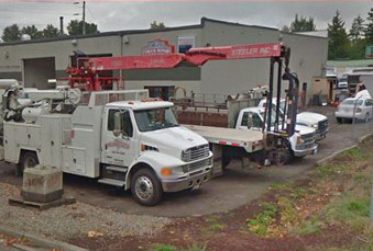
• In the remainder of the area, limited light industrial, warehousing, City services, service commercial uses such as auto or furniture repair, and small offices are appropriate. Two large retail storage uses exist in the LIT area and provide useful storage space to nearby residents and businesses but absorb valuable space in a well-situated industrial and commercial zone in close proximity to Downtown.
|
|
|
|
Retail storage establishment |
|
Additional, new retail storage uses, along with other uses that do not promote the smaller-scale commercial and industrial character of the district, should be discouraged. These types of uses take up a significant amount of land but provide limited economic activity and absorb land that could otherwise be utilized for industrial and commercial activities.
Policy N-20:
Encourage businesses that promote environmentally sustainable technologies.
Sustainable green technology provides benefits to Kirkland’s economy and the neighborhood. The rapidly expanding new energy/clean technology industry sector promotes environmental stewardship and a vibrant economy.
Policy N-21:
Regulate industrial uses to ensure that impacts which may disrupt the residential character of the surrounding area are controlled.
Techniques to minimize noise, glare, light, dust, fumes, parking and other adverse conditions, found in the policies in the Community Character Element of the Comprehensive Plan, and limiting hours of operation, should be used so that industrial activities do not create conflicts with surrounding residential development.
Policy N-22:
Industrial traffic should be controlled in order to protect the character, safety, and peace of the residential neighborhood.
Industrial truck traffic should avoid passing through residential areas. Industrial traffic should be directed to 8th Street south of 12th Avenue, 7th Avenue between 6th Street and the Cross Kirkland Corridor, 6th Street between 7th Avenue and Central Way, and the NE 87th Street/114th Avenue NE connection between the Cross Kirkland Corridor and NE 85th Street in the Highlands Neighborhood. There should be no access from 12th Avenue into the industrial area. Additionally, 11th Avenue should remain closed to industrial access.
Policy N-23:
Promote land uses, mobility improvements, and new infrastructure that support transit-oriented development around the I-405/NE 85th Street Bus Rapid Transit (BRT) Station and the associated Station Area Plan.
The south portion of the Norkirk Neighborhood is located within the boundaries of the Greater Downtown Kirkland Urban Center and future Station Area Plan surrounding the Bus Rapid Transit (BRT) Station. To maximize use of transit at the BRT Station, land use changes and infrastructure improvements in the southern portion of the neighborhood may be necessary to maximize access to the BRT Station and achieve the mixed use, transit-oriented development goals of the future Station Area Plan.


